Area Overview for CT1 1PS
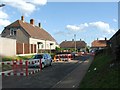
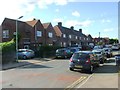
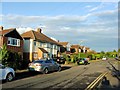
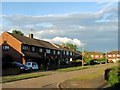
Photos of CT1 1PS


Area Information
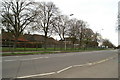
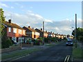
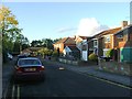
Living in CT1 1PS means being part of a compact, historic residential cluster within Canterbury, a UNESCO World Heritage Site. The area covers just 2.9 hectares, housing 1,373 people in a densely packed environment. Its location within the Barton Ward ties it to Canterbury’s medieval roots, with proximity to sites like Barton Hall and Jesus Hospital. Daily life here is shaped by its small-scale character, where the population density of 47,126 people per square kilometre reflects a tightly knit community. Residents benefit from proximity to Canterbury’s cultural and historical landmarks, while the area’s limited size means a focus on local amenities and transport links. The postcode’s blend of heritage and practicality makes it distinct, with a population skewed toward adults aged 30-64, suggesting a mature, established demographic. For buyers, CT1 1PS offers a rare mix of historic significance and modern connectivity, though its small footprint means every decision about living here is deliberate.
- Area Type
- Postcode
- Area Size
- 2.9 hectares
- Population
- Not available
- Population Density
- Not available
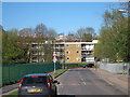
The property market in CT1 1PS is characterised by a low home ownership rate of 28%, suggesting a strong rental market rather than a focus on owner-occupied homes. The accommodation type is predominantly houses, which, given the area’s limited size, may indicate a mix of larger properties or multi-generational living. This dynamic could appeal to investors seeking rental income or buyers looking for characterful homes in a historic setting. However, the small footprint of the area means competition for properties is likely high, with limited scope for expansion. For buyers, the market’s focus on rental properties may present opportunities, but the lack of data on housing stock specifics means understanding local supply and demand requires further local insight.
House Prices in CT1 1PS
No properties found in this postcode.
Energy Efficiency in CT1 1PS
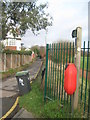
Residents of CT1 1PS have access to essential retail and transport hubs within practical reach. The area’s proximity to major supermarkets like Tesco Canterbury, Waitrose Canterbury, and Sainsburys Canterbury Old ensures everyday shopping needs are met without long commutes. Nearby rail stations, including Canterbury East and Sturry, provide easy access to regional and national transport networks, enhancing connectivity for commuters. While the area’s small size limits large-scale leisure facilities, its integration into Canterbury’s historic fabric means cultural and heritage sites are within walking distance. The presence of multiple retail outlets and transport links contributes to a convenient, if compact, lifestyle, ideal for those prioritising accessibility over expansive green spaces.
Amenities
Schools
| Rank | School | Type | Entry gender | Ages |
|---|
Explore more schools in this area
Go to Schools tabDemographics
The community in CT1 1PS is predominantly composed of adults aged 30-64, with a median age of 47. This suggests a mature population, likely settled in long-term homes or retirement properties. Home ownership is low at 28%, indicating a rental market dominated by private landlords or housing associations. The accommodation type is primarily houses, which, given the area’s small size, may imply larger properties or shared living arrangements. The predominant ethnic group is White, with no specific data on other demographics. The high population density of 47,126 people per square kilometre raises questions about living space per person, though the area’s compact nature means proximity to amenities is a key feature. For residents, this density may foster a close-knit environment but could also present challenges in terms of privacy or space.
Household Size
Accommodation Type
Tenure
Ethnic Group
Religion
Household Composition
Age
Household Deprivation
NS-SEC
Explore more demographic insights in this area
Go to Demographics tabPlanning
Planning Constraints
- Flood RiskPremium
- Ramsar Wetland SitesPremium
- Area of Outstanding Natural BeautyPremium
- Protected Nature ReservePremium
- Protected WoodlandPremium
- Crime RiskPremium