Area Overview for CT1 1FJ
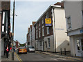
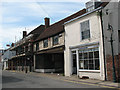
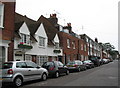
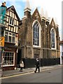
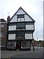
Photos of CT1 1FJ
Area Information
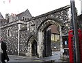
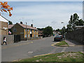
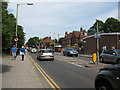
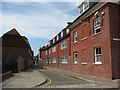
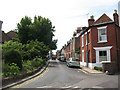
Living in CT1 1FJ means inhabiting a small, densely populated residential cluster in the heart of Canterbury, Kent. The area covers just 2,094 square metres, yet it is home to 2,868 people, translating to a population density of over 1.3 million per square kilometre. This compact postcode sits within Northgate Ward, historically linked to Canterbury’s medieval walls and the former North Gate. Daily life here is shaped by its proximity to the city’s core, with a mix of historic and modern influences. The area’s young demographic—median age 22—suggests a community of students, young professionals, and families. Nearby amenities, including retail hubs and rail links, provide practical convenience, while the area’s compact size ensures everything is within walking distance. However, the high population density and limited space mean the area feels more like a microcosm of urban living than a sprawling suburb. For those seeking a compact, connected lifestyle with access to Canterbury’s cultural and economic assets, CT1 1FJ offers a distinct blend of history and modernity.
- Area Type
- Postcode
- Area Size
- 2094 m²
- Population
- Not available
- Population Density
- Not available
The property market in CT1 1FJ is characterised by low home ownership—just 29% of residents own their homes—suggesting a rental-dominated market. Despite this, the accommodation type is primarily houses, which is atypical for a high-density postcode. This combination implies a scarcity of available properties, with demand likely outstripping supply. The small area size (2,094 m²) further limits housing stock, making the market competitive for buyers. For those seeking owner-occupied homes, the focus on houses rather than apartments or flats may appeal to families or individuals prioritising space. However, the low home ownership rate indicates that many residents are renters, potentially driving up rental prices. Buyers should consider the area’s compact nature and its proximity to Canterbury’s central amenities, though the limited property pool may require flexibility in location or property type.
House Prices in CT1 1FJ
No properties found in this postcode.
Energy Efficiency in CT1 1FJ
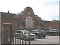
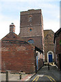
The lifestyle in CT1 1FJ is defined by proximity and practicality. Within walking distance are five retail venues, including Farmfoods Canterbury, Asda Canterbury, and Aldi Sturry, providing everyday shopping convenience. The area’s rail connections to Canterbury West, East, and Sturry stations make commuting straightforward, with services linking to London and the South East. While there is no mention of parks or leisure facilities in the data, the historical context of Northgate Ward—once home to medieval walls and a deconsecrated church—adds cultural depth. The compact size of the area means amenities are accessible, though the high population density may limit private outdoor space. For residents, this balance of retail, transport, and historical heritage creates a functional yet tightly packed urban environment.
Amenities
Schools
Residents of CT1 1FJ have access to two notable schools. Parkside Community Primary School, a primary school with a ‘good’ Ofsted rating, serves the area’s younger population, offering a solid foundation for early education. The Willows, another school listed in the data, is categorised as ‘other,’ which may indicate a specialist or alternative educational setting, though its exact role is unspecified. The presence of a primary school with a positive rating is a key draw for families, though the absence of secondary schools within the area means students may need to commute to nearby Canterbury schools. The mix of school types suggests a focus on early education but leaves gaps for older children, requiring careful planning for families with multiple children.
| Rank | School | Type | Entry gender | Ages |
|---|---|---|---|---|
| 1 | Parkside Community Primary School | primary | N/A | N/A |
| 2 | The Willows | other | N/A | N/A |
Explore more schools in this area
Go to Schools tabDemographics
The community in CT1 1FJ is predominantly young, with a median age of 22 and the most common age range being 15–29 years. This suggests a population skewed towards students, early-career professionals, and young families. Home ownership is low at 29%, indicating that a majority of residents rent their properties. The accommodation type is primarily houses, which is unusual for a high-density area, suggesting a mix of smaller, single-family homes and possibly converted properties. The predominant ethnic group is White, though no specific data on diversity or deprivation is provided. The high population density—over 1.3 million people per square kilometre—raises questions about housing pressure and community dynamics. For residents, this means a tightly knit but potentially transient population, with limited space for expansion. The area’s youthful profile and rental focus may appeal to those prioritising affordability and proximity to Canterbury’s amenities over long-term stability.
Household Size
Accommodation Type
Tenure
Ethnic Group
Religion
Household Composition
Age
Household Deprivation
NS-SEC
Explore more demographic insights in this area
Go to Demographics tabPlanning
Planning Constraints
- Flood RiskPremium
- Ramsar Wetland SitesPremium
- Area of Outstanding Natural BeautyPremium
- Protected Nature ReservePremium
- Protected WoodlandPremium
- Crime RiskPremium