Area Overview for CT1 1FG
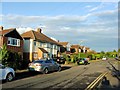
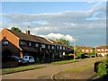
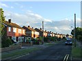
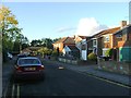
Photos of CT1 1FG
Area Information
Living in CT1 1FG means being part of a compact residential cluster nestled within Canterbury’s historic heart. This postcode area, covering just 1,078 square metres, is densely populated with 1,373 residents, reflecting the tight-knit character of the City of Canterbury unitary authority. The area falls within Barton Ward, a historic electoral division linked to medieval Canterbury, with landmarks like Barton Hall and proximity to Jesus Hospital. Its location near the UNESCO World Heritage Site adds a layer of cultural significance, though daily life here is defined by practicality. Residents benefit from proximity to Canterbury’s amenities, including retail hubs and rail links, while the high population density underscores the area’s role as a central, lived-in part of the city. The mix of historic and modern elements—such as nearby supermarkets like Tesco Canterbury and Sainsburys Canterbury Old—creates a balance between tradition and convenience. For those seeking a compact, well-connected urban environment, CT1 1FG offers a blend of heritage and accessibility, though its small size means every home is closely situated to its neighbours.
- Area Type
- Postcode
- Area Size
- 1078 m²
- Population
- Not available
- Population Density
- Not available
The property market in CT1 1FG is characterised by low home ownership, with only 28% of residents owning their homes. This suggests that the area is more rental-oriented than owner-occupied, which may influence the types of properties available. The accommodation type is predominantly houses, which is notable given the area’s small size and high population density. This mix implies a limited stock of larger homes, possibly concentrated in specific parts of the postcode. For buyers, the small area size and high density may mean competition for available properties, particularly if demand outstrips supply. The focus on houses rather than flats or apartments could appeal to those seeking more space, though the compact nature of CT1 1FG may restrict options. Prospective buyers should consider the area’s proximity to Canterbury’s amenities, which could offset the challenges of a limited housing stock. However, the low home ownership rate suggests that rental prices or availability might be key factors for those considering long-term residence.
House Prices in CT1 1FG
No properties found in this postcode.
Energy Efficiency in CT1 1FG
Residents of CT1 1FG have access to a range of nearby amenities that support daily life. The area is within practical reach of five retail outlets, including major supermarkets like Tesco Canterbury, Sainsburys Canterbury Old, and Waitrose Canterbury, ensuring convenience for shopping and grocery needs. The proximity to Canterbury’s historic sites, such as Barton Hall and Jesus Hospital, adds cultural and historical interest to the local environment. While the area itself is small, its connection to Canterbury’s broader network means residents can easily access parks, leisure facilities, and dining options in the city. The presence of multiple railway stations, including Canterbury East and West, enhances mobility, allowing quick access to other parts of Kent and beyond. This blend of retail, transport, and heritage creates a lifestyle that balances practicality with the charm of a historic city, though the compact size of CT1 1FG means amenities are closely concentrated.
Amenities
Schools
| Rank | School | Type | Entry gender | Ages |
|---|
Explore more schools in this area
Go to Schools tabDemographics
The community in CT1 1FG is predominantly middle-aged, with a median age of 47 and the most common age range being 30–64 years. This suggests a stable population of working-age adults, many of whom may be retired or in established careers. Home ownership is relatively low at 28%, indicating that a significant portion of the housing stock is rented. The accommodation type is primarily houses, which is unusual for a high-density area, hinting at a mix of larger properties or detached homes. The predominant ethnic group is White, reflecting the demographic profile of Canterbury as a whole. With no data on deprivation levels, it is unclear how economic factors might influence quality of life, but the high population density—1,273,930 people per square kilometre—suggests a compact, possibly mixed-use environment where residents share limited space. This density may impact community interaction, though the lack of specific data on social cohesion means its effects remain speculative.
Household Size
Accommodation Type
Tenure
Ethnic Group
Religion
Household Composition
Age
Household Deprivation
NS-SEC
Explore more demographic insights in this area
Go to Demographics tabPlanning
Planning Constraints
- Flood RiskPremium
- Ramsar Wetland SitesPremium
- Area of Outstanding Natural BeautyPremium
- Protected Nature ReservePremium
- Protected WoodlandPremium
- Crime RiskPremium