Area Overview for CT1 1EN
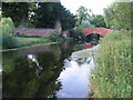
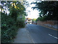
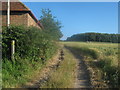
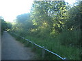
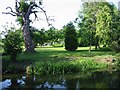
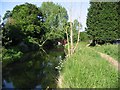
Photos of CT1 1EN


Area Information
Living in CT1 1EN means being part of a compact, densely populated residential cluster within the historic city of Canterbury, a UNESCO World Heritage Site. The area covers 31.7 hectares and is home to 2,085 residents, with a population density of 1,037 people per square kilometre. This postcode lies within Barton Ward, a historic electoral district encompassing parts of Canterbury’s medieval precincts, including Barton Hall, once linked to the Culpeper family. The area’s proximity to Canterbury’s landmarks, such as Jesus Hospital and the city’s ancient boundaries, offers a blend of historical significance and modern convenience. Daily life here is shaped by its small-scale nature, with residents likely to know their neighbours and benefit from easy access to the city’s cultural and administrative hubs. While the area is residential, its limited size means it is closely integrated with Canterbury’s broader urban fabric, blending historic charm with contemporary amenities.
- Area Type
- Postcode
- Area Size
- 31.7 hectares
- Population
- 2085
- Population Density
- 1037 people/km²
The property market in CT1 1EN is defined by its 36% home ownership rate, with houses forming the primary accommodation type. This suggests a limited housing stock focused on owner-occupied properties, though the low ownership percentage indicates a strong rental market. Given the area’s small size and high population density, the housing stock is likely constrained, making it a competitive market for buyers. The predominance of houses over flats or apartments may appeal to those seeking more space, though the compact nature of the postcode means properties are closely clustered. Buyers should consider the area’s integration with Canterbury’s broader infrastructure, as nearby amenities and transport links may influence property values. The small scale of CT1 1EN also means that any property purchase here is likely to be part of a tightly knit local market.
House Prices in CT1 1EN
No properties found in this postcode.
Energy Efficiency in CT1 1EN
Residents of CT1 1EN have access to a range of nearby amenities within practical reach. Retail options include Iceland Stour, M&S Maybrook Canterbury, and Aldi Sturry, offering everyday shopping needs. The area’s rail connectivity is a key feature, with five stations—including Sturry and Canterbury West—providing easy access to the city’s broader transport network. While the postcode itself is small, its integration with Canterbury’s urban core means residents can also access the city’s cultural, educational, and commercial hubs. The presence of historic sites like Barton Hall and proximity to medieval precincts add a unique character to daily life, blending heritage with modern convenience. For those prioritising practicality, the combination of retail, transport, and historical context makes CT1 1EN a functional yet distinctive place to live.
Amenities
Schools
| Rank | School | Type | Entry gender | Ages |
|---|
Explore more schools in this area
Go to Schools tabDemographics
CT1 1EN has a median age of 22, though the most common age range among residents is 30–64 years. This suggests a mix of younger and middle-aged adults, with a notable absence of younger children or retirees. Home ownership in the area stands at 36%, indicating that a majority of residents rent their homes. The predominant accommodation type is houses, which is unusual in a high-density area, suggesting a focus on single-family dwellings. The population is predominantly White, with no specific data provided on other ethnic groups. The relatively low home ownership rate may reflect the area’s character as a rental-focused zone, potentially influenced by its proximity to Canterbury’s employment and educational opportunities. For buyers, this dynamic could mean competition for available properties and a need to consider long-term rental viability.
Household Size
Accommodation Type
Tenure
Ethnic Group
Religion
Household Composition
Age
Household Deprivation
NS-SEC
Explore more demographic insights in this area
Go to Demographics tabPlanning
Planning Constraints
- Flood RiskPremium
- Ramsar Wetland SitesPremium
- Area of Outstanding Natural BeautyPremium
- Protected Nature ReservePremium
- Protected WoodlandPremium
- Crime RiskPremium