Area Overview for CT1 1DW
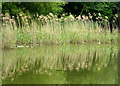
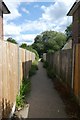
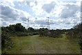
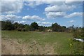
Photos of CT1 1DW


Area Information
Living in CT1 1DW places you in a small residential cluster within Canterbury’s Northgate Ward, a historically significant part of the city. This area, covering 3,282 m², is densely populated, with 2,868 residents packed into a space that reflects Canterbury’s medieval past. The ward’s name derives from the North Gate, a Roman-era structure that once marked the city’s boundary. Today, the area is defined by its proximity to Canterbury’s historic core, with landmarks like St Mary Northgate Church, now owned by King’s School, and the Northgate Ward Community Centre. Daily life here is shaped by its compact size and links to the city’s heritage, offering residents a blend of urban convenience and historical character. Nearby, railway stations like Canterbury West and Sturry provide easy access to the city and beyond, while local shops and schools cater to a young, active population. The area’s small footprint means it is ideal for those seeking a close-knit community with direct access to Canterbury’s amenities.
- Area Type
- Postcode
- Area Size
- 3282 m²
- Population
- Not available
- Population Density
- Not available
The property market in CT1 1DW is shaped by a low home ownership rate (29%) and a focus on houses as the primary accommodation type. This suggests a market where rental properties dominate, likely catering to students, young professionals, or those seeking short-term stays. The small area size—just 3,282 m²—means housing stock is limited, which could drive competition among buyers or renters. Given the youthful demographic, properties may be designed for single occupants or small families, with a lack of larger housing options. Buyers should consider that the area’s compact nature may restrict availability, and its proximity to Canterbury’s amenities could be a key selling point. However, the high population density might also mean limited scope for expansion or development, making this a niche market for those prioritising location over space.
House Prices in CT1 1DW
No properties found in this postcode.
Energy Efficiency in CT1 1DW
Residents of CT1 1DW benefit from nearby retail and transport hubs, with five notable retail venues including Farmfoods Canterbury, Aldi Sturry, and Asda Canterbury. These shops provide convenience for daily essentials, though the area’s small size means choices are limited to major chains. The proximity to multiple railway stations enhances mobility, allowing easy access to Canterbury’s cultural and commercial centres. While the data does not mention parks or leisure facilities, the area’s historical sites—such as the North Gate and St Mary Northgate Church—offer cultural enrichment. The compact nature of CT1 1DW means amenities are within walking distance, fostering a sense of convenience. However, the absence of detailed information on parks or recreational spaces suggests residents may need to venture further for outdoor activities. The blend of retail, transport, and heritage sites creates a functional, if modest, lifestyle for those prioritising accessibility over expansive leisure options.
Amenities
Schools
Residents of CT1 1DW have access to Parkside Community Primary School, a primary school with a ‘good’ Ofsted rating, and The Willows, which is categorised as an ‘other’ school. The presence of a primary school with a strong rating is a significant draw for families, offering a reliable educational foundation for young children. However, the second school’s unspecified type leaves uncertainty about its role—whether it serves as a secondary institution, specialist academy, or alternative provision. This mix suggests a basic but limited range of educational options, which may require families to consider commuting to other parts of Canterbury for secondary education. The area’s schools reflect a focus on primary education, aligning with the youthful population profile but potentially leaving gaps for older students.
| Rank | School | Type | Entry gender | Ages |
|---|---|---|---|---|
| 1 | Parkside Community Primary School | primary | N/A | N/A |
| 2 | The Willows | other | N/A | N/A |
Explore more schools in this area
Go to Schools tabDemographics
CT1 1DW has a median age of 22, with the most common age range being 15–29 years. This indicates a youthful population, likely dominated by students, young professionals, or families with children. Only 29% of residents own their homes, suggesting a rental market that accommodates transient or younger demographics. The predominant accommodation type is houses, which may reflect the area’s residential character and limited density. The predominant ethnic group is White, though no specific data on diversity or deprivation is provided. The high population density—873,905 people per km²—suggests a compact, possibly overpopulated environment, which could influence living conditions and access to space. This demographic profile implies a community focused on affordability, education, and proximity to Canterbury’s urban offerings, with potential challenges in housing availability and personal space.
Household Size
Accommodation Type
Tenure
Ethnic Group
Religion
Household Composition
Age
Household Deprivation
NS-SEC
Explore more demographic insights in this area
Go to Demographics tabPlanning
Planning Constraints
- Flood RiskPremium
- Ramsar Wetland SitesPremium
- Area of Outstanding Natural BeautyPremium
- Protected Nature ReservePremium
- Protected WoodlandPremium
- Crime RiskPremium