Area Overview for CT1 1AT
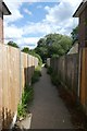
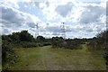
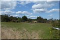
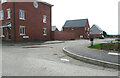
Photos of CT1 1AT


Area Information
Living in CT1 1AT means being part of a compact, historically rich residential cluster within Canterbury’s UNESCO World Heritage Site. The area, covering 6,466 square metres, is home to 2,085 people, giving it a dense population of 1,037 people per square kilometre. This small postcode area sits within Barton Ward, a historic electoral division that includes landmarks like Barton Hall, linked to the Culpeper family, and medieval precincts noted in 17th-century records. Daily life here is shaped by its proximity to Canterbury’s cultural and architectural heritage, with easy access to rail networks and local amenities. While the area is small, its connection to the city’s ancient roots offers a unique blend of history and modern convenience. Residents benefit from proximity to Canterbury’s rail stations, including Canterbury East and Sturry, which link to broader regional transport routes. The compact size means a tight-knit community, though the population density may influence the pace of life. For those seeking a mix of heritage and practicality, CT1 1AT provides a distinct character within the larger Canterbury framework.
- Area Type
- Postcode
- Area Size
- 6466 m²
- Population
- 2085
- Population Density
- 1037 people/km²
The property market in CT1 1AT is characterised by a low rate of home ownership—just 36% of properties are owner-occupied—suggesting a strong rental presence. Despite this, the area is predominantly composed of houses rather than flats or apartments, which is atypical for a small postcode. This mix may reflect a demand for family homes in a compact, historic setting, though the limited number of properties means the market is likely constrained. Buyers should consider that the area’s small size may limit availability, and competition for rental properties could be fierce. The predominance of houses may appeal to those seeking more space, but the high population density—1,037 people per square kilometre—could mean proximity to neighbours. For those prioritising ownership, the low home ownership rate might indicate opportunities, but the small area’s limited stock could make it a niche market.
House Prices in CT1 1AT
No properties found in this postcode.
Energy Efficiency in CT1 1AT
Residents of CT1 1AT have access to a range of local amenities within practical reach. The retail options include Aldi Sturry, Farmfoods Canterbury, and Iceland Stour RP, providing essential shopping for daily needs. The proximity to Canterbury’s railway stations—Canterbury East, Canterbury West, and Sturry—ensures easy access to the city’s cultural and commercial hubs. While the area is small, its location within Canterbury’s historic core means residents can explore the UNESCO-listed city centre, including its medieval architecture and heritage sites. The compact nature of the area fosters a convenient lifestyle, with amenities clustered closely. However, the lack of specific data on parks or leisure facilities means the full extent of recreational options is unclear. For those prioritising convenience, the availability of shops and transport links makes CT1 1AT a practical choice, though the area’s size may limit broader leisure opportunities.
Amenities
Schools
| Rank | School | Type | Entry gender | Ages |
|---|
Explore more schools in this area
Go to Schools tabDemographics
CT1 1AT has a median age of 22, but the most common age group among residents is adults aged 30–64, suggesting a mix of established households and younger professionals. Home ownership here is relatively low, with only 36% of properties owner-occupied, indicating a rental market dominance. The area is predominantly composed of houses, which is unusual for a small postcode, and the majority of the population identifies as White. The high population density—1,037 people per square kilometre—suggests a compact, possibly multi-generational living environment. While no specific data on deprivation is provided, the combination of low home ownership and dense living conditions may influence access to private space and community resources. The age profile implies a balance between family-oriented and single-adult households, though the lack of data on diversity metrics means the full demographic picture remains incomplete.
Household Size
Accommodation Type
Tenure
Ethnic Group
Religion
Household Composition
Age
Household Deprivation
NS-SEC
Explore more demographic insights in this area
Go to Demographics tabPlanning
Planning Constraints
- Flood RiskPremium
- Ramsar Wetland SitesPremium
- Area of Outstanding Natural BeautyPremium
- Protected Nature ReservePremium
- Protected WoodlandPremium
- Crime RiskPremium