Area Overview for Crowmarsh
Photos of Crowmarsh

Area Information
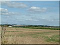
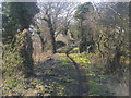
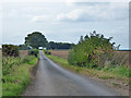
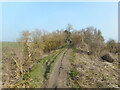
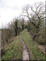
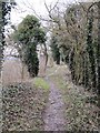
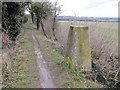
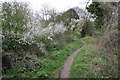
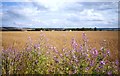
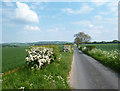
Living in Crowmarsh offers a distinctly rural experience within the civil parish of the same name. This area spans 12.0 km², providing a substantial footprint for a community characterised by quieter days and a deep connection to the surrounding landscape. You will find a location that prioritises space and tranquility, making it a compelling choice for those seeking a relaxed pace of life away from urban congestion. The parish setting defines the daily rhythm, where the environment shapes both lifestyle and property values. The area presents a clear picture of where people choose to settle for long-term stability. With a specific emphasis on established neighbourhoods, Crowmarsh stands apart from developing zones or rapidly changing districts. Every aspect of life here revolves around the practicalities of a settled community. Prospective buyers looking for a defined area with clear boundaries and a known character will appreciate the straightforward nature of this parish. It is a place where the local identity is anchored in its physical geography and resident history rather than transient trends.
- Area Type
- Parish
- Area Size
- 12.0 km²
- Population
- Not available
- Population Density
- Not available
Demographics
The community in Crowmarsh reflects a settled population with well-defined characteristics. The median age of 70 indicates a predominantly older demographic, suggesting that many residents have established here for an extended period. This age profile shapes the social fabric and the types of amenities prioritised within the parish. You are looking at an area where long-term permanence is the norm rather than exception. Home ownership stands at 72%, which confirms that most residents hold their properties outright or have significant equity stakes. This high rate of ownership contrasts sharply with high-rent districts and points to a market driven by stability. The household composition data further supports the view that families and individuals in Crowmarsh tend to stay put rather than move frequently. While specific ethnic group statistics and religious affiliations are not detailed in the available records, the overall picture is one of a homogeneous, resident-focused community. The demographic data paints a clear portrait of an area where people plan to age in place, relying on a network of neighbours who share similar life stages and priorities.
Household Size
Accommodation Type
Tenure
Ethnic Group
Religion
Household Composition
Age
Household Deprivation
NS-SEC
Explore more demographic insights in this area
Go to Demographics tabPlanning
Planning Constraints
- Flood RiskPremium
- Ramsar Wetland SitesPremium
- Area of Outstanding Natural BeautyPremium
- Protected Nature ReservePremium
- Protected WoodlandPremium
- Crime RiskPremium