Area Overview for Crowborough St. Johns Ward
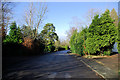
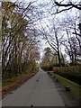
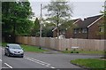
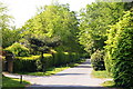
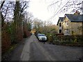
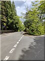
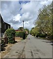
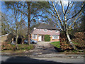
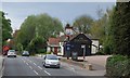
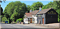
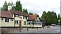
Photos of Crowborough St. Johns Ward

Area Information
Living in Crowborough St. Johns Ward offers a distinct experience within the larger district. You are settling into a district borough unitary ward that covers just 3.5 square kilometres. This compact size means amenities and local routes are rarely far from your door. The character of the area is shaped by its mature residents and high rate of local ownership. Daily life here revolves around a stable, long-standing community where neighbours often know one another well. You will find that the ward stands apart from rapidly expanding suburbs, maintaining a quieter rhythm despite its proximity to larger towns. The layout supports a low-impact lifestyle where walking and local services play a central role in routine. While the small footprint might suggest limited space, the density is managed efficiently to preserve residential peace. Homebuyers looking for a tightly knit environment will recognise the benefits of such a contained geographical boundary. Understanding the scale of this ward helps you appreciate the immediacy of local interactions and the stability of the neighbourhood.
- Area Type
- District Borough Unitary Ward
- Area Size
- 3.5 km²
- Population
- Not available
- Population Density
- Not available
Demographics
The community in Crowborough St. Johns Ward is defined by an older population profile. The median age here is 70 across the total population. This figure indicates that most residents are well into retirement life, creating a demographic focused on later-stage adulthood and established routines. Consequently, you will encounter a neighbourhood where experiences are shared among those with significant life history. Home ownership levels reflect this settled demographic, with 88 per cent of households owning their property. Such a high proportion of owner-occupiers signals a deep-rooted commitment to the local area and stability within the streets. Accommodation types, while not detailed by specific building categories in the current profile, align with this ownership pattern. The community composition suggests a traditional local structure rather than a transient or student-heavy zone. For anyone considering homes in Crowborough St. Johns Ward, the social fabric remains anchored by these long-term owners who have raised families or enjoyed their retirement in place for many years.
Household Size
Accommodation Type
Tenure
Ethnic Group
Religion
Household Composition
Age
Household Deprivation
NS-SEC
Explore more demographic insights in this area
Go to Demographics tabPlanning
Planning Constraints
- Flood RiskPremium
- Ramsar Wetland SitesPremium
- Area of Outstanding Natural BeautyPremium
- Protected WoodlandPremium
- Crime RiskPremium