Area Overview for Crowborough North Ward
Photos of Crowborough North Ward
Area Information
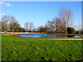
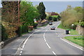
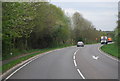
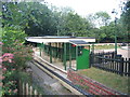
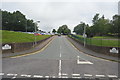
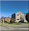
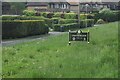
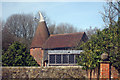
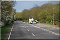
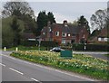
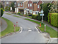
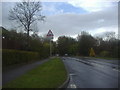
Living in Crowborough North Ward offers a distinct lifestyle on the northern edge of the town and civil parish of Crowborough. This electoral ward sits within the High Weald Area of Outstanding Natural Beauty, placing you approximately seven miles south-west of Royal Tunbridge Wells. The area encompasses key neighbourhoods including Jarvis Brook, Goldsmiths, and Beeches. You will find the land situated at elevations reaching up to 242 metres above sea level, near the Ashdown Forest. The ward covers a total area size of 1.6 square kilometres, making it a compact yet elevated community. Crowborough railway station serves the Jarvis Brook portion of the ward, providing access to the Oxted Line operated by Southern. Journeys to London Bridge take approximately one hour from this location. The settlement point is centrally located at approximately 51.06°N 0.16°E. Major road links include the A26, which runs north-east through Tunbridge Wells to Tonbridge and south to Uckfield and Lewes. Local routes like the B2100 connect eastward to Jarvis Brook, while the B2157 links Steel Cross and Crowborough Hill. You are essentially residing 33 miles south of London in the South East region. Daily life here is defined by proximity to both rural natural settings and established town infrastructure.
- Area Type
- District Borough Unitary Ward
- Area Size
- 1.6 km²
- Population
- Not available
- Population Density
- Not available
Demographics
The community profile of Crowborough North Ward is heavily influenced by its age structure and long-term residency patterns. The median age stands at 70 years, indicating a population skewed significantly towards older residents. Although the most common age range data is recorded as "Age: Total" in the available records, the high median age suggests a retirement-oriented demographic. Home ownership is the dominant form of tenure, with 86% of residents owning their homes outright. This high level suggests very few households are renting privately or locally. The ward records no specific data on household composition, predominant ethnic group distribution, or religious affiliation in the current dataset. Consequently, these demographic facets remain undefined within the official reports for this specific ward. The extensive home ownership rate implies stability, as the people living here are likely deeply embedded in the local community. Buyers should expect an area where long-term residents dominate the housing stock rather than transient families or students. The lack of detailed diversity statistics means the social makeup is not quantified beyond these broad tenure and age indicators.
Household Size
Accommodation Type
Tenure
Ethnic Group
Religion
Household Composition
Age
Household Deprivation
NS-SEC
Explore more demographic insights in this area
Go to Demographics tabPlanning
Planning Constraints
- Flood RiskPremium
- Ramsar Wetland SitesPremium
- Area of Outstanding Natural BeautyPremium
- Protected Nature ReservePremium
- Protected WoodlandPremium
- Crime RiskPremium