Area Overview for Crouch
Photos of Crouch


Area Information
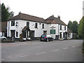
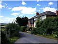
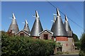
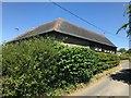
Crouch is a compact built-up area in England, spanning just 21.9 hectares. Its small size suggests a tightly knit community, where daily life is shaped by proximity to essential services and local amenities. The area’s median age of 70 indicates a population skewed towards older residents, which may influence the character of the neighbourhood. With 82% of homes owned by their occupants, Crouch is predominantly a place of long-term residency rather than transient rental properties. The presence of five nearby railway stations, including Borough Green & Wrotham and West Malling, offers convenient access to regional transport networks. Retail options within walking distance, such as Sainsburys Borough Green and Co-op Borough, provide practical support for everyday needs. While the area’s size is modest, its infrastructure and amenities suggest a functional, if unpretentious, quality of life for residents.
- Area Type
- Built Up Area 250
- Area Size
- 21.9 hectares
- Population
- Not available
- Population Density
- Not available
Crouch’s lifestyle is shaped by its proximity to essential amenities. Within practical reach are five railway stations, including Borough Green & Wrotham, offering easy access to regional travel. Retail options are well-served by Sainsburys Borough Green, Co-op Borough, and Waitrose Little Waitrose, ensuring residents can access groceries and daily necessities without long journeys. The absence of detailed data on leisure or recreational facilities means the area’s character beyond shopping and transport is less defined. However, the presence of multiple retail and rail options suggests a functional, if unremarkable, daily life focused on convenience and connectivity.
Amenities
Schools
| Rank | School | Type | Entry gender | Ages |
|---|
Explore more schools in this area
Go to Schools tabDemographics
Crouch’s population is defined by its median age of 70, placing it well above the national average. This suggests a community where older residents form a significant proportion of the population, potentially shaping local services and social dynamics. Home ownership is high, with 82% of properties occupied by their owners, indicating a stable residential base. The data does not specify household composition or accommodation types, but the overall figures suggest a settled, less transient population. No details are available on ethnic diversity or religious composition, but the absence of specific categories implies a homogeneous demographic profile. For buyers, this may mean a neighbourhood with established routines and a focus on long-term living rather than rapid development.
Household Size
Accommodation Type
Tenure
Ethnic Group
Religion
Household Composition
Age
Household Deprivation
NS-SEC
Explore more demographic insights in this area
Go to Demographics tabPlanning
Planning Constraints
- Crime RiskPremium