Area Overview for Cropredy, Sibfords & Wroxton Ward
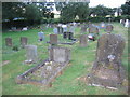
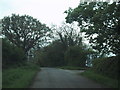
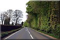
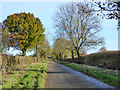
Photos of Cropredy, Sibfords & Wroxton Ward
Area Information
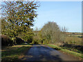
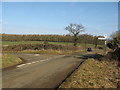
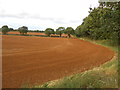
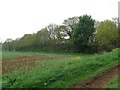
Living in Cropredy, Sibfords & Wroxton Ward offers a distinct lifestyle centred on rural Oxfordshire. This district borough unitary ward spans 122.1 square kilometres, providing a significant expanse of countryside for residents to explore. The area does not border internationally sensitive Ramsar wetland sites, nor does it fall within the boundaries of an Area of Outstanding Natural Beauty or a protected nature reserve. While these conservation designations do not hinder development, they do shape the landscape and limit certain building proposals. You will find homes in this ward situated far from urban congestion, which suits those who prioritise space and tranquility over proximity to city centres. The quiet nature of the location appeals to retirees and remote workers seeking a slower pace of life without sacrificing essential services. Daily life here involves navigating a wide area where the 122.1 km² footprint ensures ample room for outdoor pursuits. The lack of planning constraints related to major nature reserves means the land use is primarily agricultural or residential. Potential buyers should understand that the open character of this ward is its defining feature. The community is stable, with a high rate of long-term residents. This area remains a stronghold for traditional rural living, where the distance between neighbours is often measured in kilometres rather than street numbers. The environment is safe and free from immediate flood risks, making it a practical choice for permanent settlement.
- Area Type
- District Borough Unitary Ward
- Area Size
- 122.1 km²
- Population
- Not available
- Population Density
- Not available
Demographics
The community within Cropredy, Sibfords & Wroxton Ward is defined by an older population structure compared to many other UK regions. The median age of residents is 70 years, reflecting a demographic where retirees and older adults form the majority of the population. This age profile influences local services and the general pace of life throughout the ward. Home ownership is exceptionally high, with 79% of households owning their property outright or with a mortgage. This figure indicates a stable community where most families have established roots for decades rather than moving frequently in search of new rental stock. The household composition mirrors the older population, with few young families raising children in this specific ward. Accommodation types reflect this ownership model, though specific breakdowns of bungalows versus detached houses are not detailed in current records. The population is predominantly white British, consistent with the broader OX7 postcode district statistics. While specific religious affiliations and ethnicity data are aggregated under general totals for this region, the social fabric remains traditional. Neither deprivation nor poverty statistics are highlighted in the available data for this specific ward, suggesting a community that does not require significant social support interventions. The absence of ranking data for deprivation means you can assume living standards align with the national average for rural Oxfordshire. This demographic stability means you join a society where neighbours have known each other for years.
Household Size
Accommodation Type
Tenure
Ethnic Group
Religion
Household Composition
Age
Household Deprivation
NS-SEC
Explore more demographic insights in this area
Go to Demographics tabPlanning
Planning Constraints
- Flood RiskPremium
- Ramsar Wetland SitesPremium
- Area of Outstanding Natural BeautyPremium
- Protected Nature ReservePremium
- Crime RiskPremium