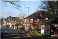
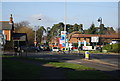
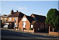
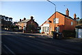
Area Overview for Crookham East Ward
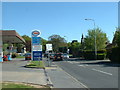
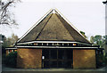
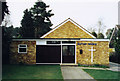
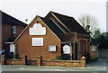
Photos of Crookham East Ward
Area Information
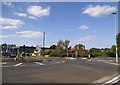
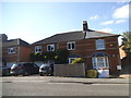
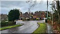
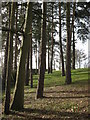
Living in Crookham East Ward means residing within a compact district borough unitary ward covering just 3.6 square kilometres in England. This specific area represents a distinct locality rather than a sprawling urban expanse, offering a concentrated living environment for its residents. The character of the ward is defined by its status as a formal administrative unit within the local government structure. You will find a community focused on the practicalities of daily life within these relatively small boundaries. The scale of the area means that neighbourhood interactions differ from those in larger cities, fostering a sense of locality despite the lack of detailed demographic breakdowns for specific age groups in the current records. Prospective homebuyers should note that this is a defined geographical entity with clear boundaries and governance structures. The area combines residential space with specific planning considerations, such as protected woodland. Your daily life here involves navigating a space that balances ownership stability with environmental safeguards. The compact nature of Crookham East Ward ensures that distances between amenities are likely short, though specific data on local shop densities remains unrecorded. You are moving into an area where the physical landscape includes designated natural features alongside residential properties. Understanding the ward's size of 3.6 km² is essential for grasping the scale of your future home.
- Area Type
- District Borough Unitary Ward
- Area Size
- 3.6 km²
- Population
- Not available
- Population Density
- Not available
Demographics
The community within Crookham East Ward has a distinct population profile, with a median age of 70 years. This figure indicates that the Ward contains a significant proportion of older residents compared to the national average. While specific data on household composition and predominant ethnic groups is not provided in the current records, the age statistic alone shapes the social fabric of the neighbourhood. Residents in Crookham East Ward are likely to be accustomed to slower-paced lifestyles typical of mature communities. The area exhibits a remarkably high rate of home ownership, standing at 88 per cent. This ownership level suggests a settled population where long-term residents have secured their property tenure. You can expect very few rental properties or transient populations within the boundaries of Crookham East Ward. The absence of data regarding religion or specific ethnic breakdowns means that detailed cultural profiling is not possible from these figures alone. However, the high home ownership rate combined with the median age paints a clear picture of a stable, established community. Buyers looking for a neighbourhood characterised by permanent residents rather than tenants will find their requirements met here. The demographic reality is one of stability, where the majority of people live in homes they own outright. This high retention rate of ownership often correlates with lower property turnover and stronger local roots.
Household Size
Accommodation Type
Tenure
Ethnic Group
Religion
Household Composition
Age
Household Deprivation
NS-SEC
Explore more demographic insights in this area
Go to Demographics tabPlanning
Planning Constraints
- Flood RiskPremium
- Ramsar Wetland SitesPremium
- Area of Outstanding Natural BeautyPremium
- Protected Nature ReservePremium
- Protected WoodlandPremium
- Crime RiskPremium