Area Overview for Cranleigh East Ward
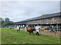
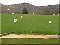
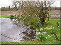
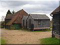
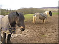
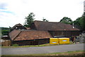
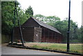
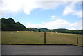
Photos of Cranleigh East Ward
Area Information
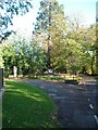
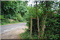
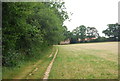
Living in Cranleigh East Ward offers a settled lifestyle within the heart of the Weald. This civil parish and electoral division sits in the north-west corner of the broader Cranleigh area, covering an area size of 11.3 km². The ward lies on a minor road east of the A281, which connects Guildford with Horsham. It is characterised by residential streets interspersed with open green spaces, parks, waterways, and recreational facilities like a bowling green. You will find a mix of houses, cottages, and unique named buildings documented on local planning maps. Cranleigh Common and Cranleigh Infant School are identifiable features within the locality. The settlement blends the quiet nature of a semi-rural Surrey village with access to local amenities. Daily life here is defined by this semi-rural setting, offering a peaceful environment away from major urban centres. The area's location places it firmly within the Waverley Borough Council jurisdiction, providing a clear administrative context for your residency. Whether you choose to live in Cranleigh East Ward or explore homes in Cranleigh, the proximity to the Weald forest region shapes the everyday experience. The landscape is a defining feature, offering views and a sense of space that city dwellers may find rare. This ward represents a specific slice of Surrey life, where the rhythm is controlled by road networks like the A281 rather than rail timetables or bus schedules.
- Area Type
- District Borough Unitary Ward
- Area Size
- 11.3 km²
- Population
- Not available
- Population Density
- Not available
Demographics
The community in Cranleigh East Ward presents a notably mature profile. You will find that 75% of residents own their homes outright or with a mortgage, indicating a settled population stable for the long term. The median age for the area stands at 70 years, reflecting a demographic dominated by older adults. This high median age suggests a neighbourhood where families with young children are less common than retirees or older couples. The data does not provide a breakdown for the most common age range beyond stating the total age, but the central tendency clearly points towards later life stages. You are less likely to encounter noise or the high energy associated with multi-generational families, while more likely to meet neighbours sharing a similar life stage. Accommodation types, ethnic group composition, and religious affiliations are recorded in the total population data but specific breakdowns are not detailed in the provided figures. Despite the lack of specific diversity statistics, the high home ownership rate and age profile suggest a traditional, stable community structure. Living in Cranleigh East Ward means joining a demographic where life experience is the shared currency. The area supports a lifestyle suited to those who have already raised their families or are focusing on retirement living rather than active parenting. This demographic reality influences local services and community engagement, creating an environment where older residents are a central part of the social fabric.
Household Size
Accommodation Type
Tenure
Ethnic Group
Religion
Household Composition
Age
Household Deprivation
NS-SEC
Explore more demographic insights in this area
Go to Demographics tabPlanning
Planning Constraints
- Flood RiskPremium
- Ramsar Wetland SitesPremium
- Area of Outstanding Natural BeautyPremium
- Protected Nature ReservePremium
- Protected WoodlandPremium
- Crime RiskPremium