Area Overview for CR6 9YR
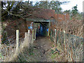
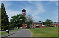
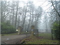
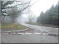
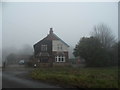
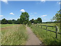
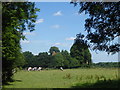
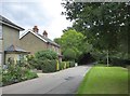
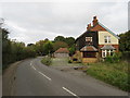
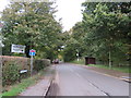
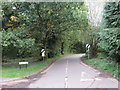
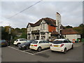
Photos of CR6 9YR
Area Information
CR6 9YR is a small residential postcode area nestled in the Metropolitan Green Belt of Surrey, approximately 15 miles south of London. It forms part of the civil parish of Chelsham and Farleigh, a rural enclave with a population of 1,942 spread across 124 people per square kilometre. The area retains a strong rural character, with open countryside dominating the landscape and only one house per 12 acres. Historically, Chelsham and Farleigh were two distinct villages that merged in 1969, resisting absorption into Greater London. Today, the parish is bounded by natural features like Great Farleigh Wood and Selsdon Nature Reserve, though it faces pressure from nearby urban sprawl in Croydon and New Addington. Daily life here is defined by a quiet, low-density environment, with residents prioritising preservation of the rural atmosphere. The area’s proximity to London—via rail links to Woldingham and Whyteleafe stations—offers easy access to the capital, while its Green Belt status ensures limited development. Living here means balancing rural tranquillity with practical connectivity to urban amenities.
- Area Type
- Postcode
- Area Size
- Not available
- Population
- 1942
- Population Density
- 124 people/km²
CR6 9YR is predominantly an owner-occupied area, with 67% of homes owned by residents rather than rented. The accommodation type is largely houses, which is typical for rural and semi-rural postcodes. This suggests a market dominated by detached or semi-detached properties, likely offering larger living spaces than urban apartments. Given the area’s small size and Green Belt designation, development is constrained, meaning property stock is limited and likely to be older, reflecting the parish’s historical character. For buyers, this means a niche market with limited new builds but potentially higher demand for existing homes. The low population density also implies that properties may be spread out, requiring consideration of commuting distances. Proximity to rail links and nearby towns like Warlingham provides access to urban amenities, but the rural setting may appeal to those seeking space and a slower pace of life. The market is likely to be competitive, with homes retaining value due to the area’s low flood risk and safe environment.
House Prices in CR6 9YR
No properties found in this postcode.
Energy Efficiency in CR6 9YR
Living in CR6 9YR offers access to a mix of retail, transport, and natural amenities. Nearby shops include Sainsburys Warlingham, Tesco Warlingham, and Co-op Hamsey, providing essential grocery and retail services. The area’s tram and rail links connect residents to larger hubs, with stations like Whyteleafe South and Upper Warlingham offering regular services. For leisure, Selsdon Nature Reserve and Puplet and Frith Woods provide opportunities for walking, cycling, and wildlife observation. The parish’s rural character is preserved through protected green spaces, though proximity to New Addington and Croydon introduces urban elements. The presence of Farleigh Court Golf Course and St Mary’s Church adds cultural and recreational value. While the area lacks large supermarkets or entertainment venues, its smaller scale ensures a quieter, community-focused lifestyle. Residents must travel to nearby towns for more extensive amenities, but the balance of nature and connectivity makes it appealing for those seeking a blend of tranquillity and practicality.
Amenities
Schools
The nearest school to CR6 9YR is Warlingham Park School, an independent institution with an Ofsted rating of satisfactory. As an independent school, it caters to families seeking private education, though it does not offer state-funded options. The absence of other schools in the immediate area means families may need to travel to nearby towns for state education. Warlingham Park School’s rating indicates it meets minimum standards but may not excel in areas like academic performance or extracurriculars compared to top-rated institutions. For those prioritising private schooling, this school offers a viable option, but it does not provide a diverse range of educational choices. Parents should consider the commute to other schools in Warlingham or Croydon if they require state alternatives. The school’s presence highlights the area’s appeal to families seeking structured, private education, though it does not address broader educational needs beyond its immediate offerings.
| Rank | School | Type | Entry gender | Ages |
|---|
Explore more schools in this area
Go to Schools tabDemographics
The population of CR6 9YR has a median age of 47, with the majority of residents aged between 30 and 64. This suggests a mature, stable community with a strong presence of middle-aged adults. Home ownership stands at 67%, indicating a mix of owner-occupied properties and rental units. The predominant accommodation type is houses, reflecting the area’s rural and semi-rural character. The dominant ethnic group is White, aligning with broader trends in the South East. With a population density of 124 people per square kilometre, the area remains sparsely populated compared to urban centres. The demographic profile implies a community focused on long-term residency, with limited presence of younger families or transient populations. This stability contributes to a cohesive local environment, though the age distribution may affect the availability of schools and youth-focused amenities. The low population density also means fewer social hubs, requiring residents to travel to nearby towns for community activities.
Household Size
Accommodation Type
Tenure
Ethnic Group
Religion
Household Composition
Age
Household Deprivation
NS-SEC
Explore more demographic insights in this area
Go to Demographics tabPlanning
Planning Constraints
- Flood RiskPremium
- Ramsar Wetland SitesPremium
- Area of Outstanding Natural BeautyPremium
- Protected Nature ReservePremium
- Protected WoodlandPremium