Area Overview for CR6 9JH
Photos of CR6 9JH
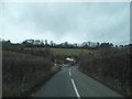
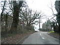
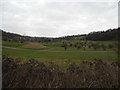

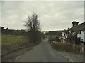
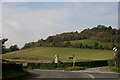
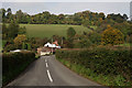
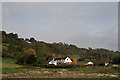
95 photos from this area
Area Information
Key information about the CR6 9JH including its size, population, and administrative classification.
- Area Type
- Postcode
- Area Size
- 10.7 hectares
- Population
- 2080
- Population Density
- 1304 people/km²
House Prices in CR6 9JH
24
Properties
£590,529
Average Sold Price
£275,000
Lowest Price
£1,325,000
Highest Price
Showing 24 properties
| Address | Type | Beds | Baths | Last Sale Price | Last Sale Date | |
|---|---|---|---|---|---|---|
| 24 Stuart Road, Warlingham, CR6 9JH | Detached | 5 | 2 | £1,300,000 | Mar 2025 | |
| 15 Stuart Road, Warlingham, CR6 9JH | Detached | 4 | 2 | £625,000 | Mar 2021 | |
| 20 Stuart Road, Warlingham, CR6 9JH | Detached | 5 | 3 | £950,000 | Feb 2021 | |
| 12 Stuart Road, Warlingham, CR6 9JH | Detached | 4 | 3 | £1,325,000 | Sep 2020 | |
| 21 Stuart Road, Warlingham, CR6 9JH | Detached | 3 | 2 | £644,000 | Jan 2017 | |
| 26 Stuart Road, Warlingham, CR6 9JH | Detached | 4 | - | £460,000 | Dec 2014 | |
| Ormesby, 7 Stuart Road, Warlingham, CR6 9JH | Detached | 4 | - | £600,000 | Mar 2014 | |
| 17 Stuart Road, Warlingham, CR6 9JH | Detached | 4 | 2 | £485,000 | Oct 2013 | |
| 23A Stuart Road, Warlingham, CR6 9JH | Detached | 6 | 6 | £450,000 | Jul 2013 | |
| 28 Stuart Road, Warlingham, CR6 9JH | house | 4 | - | £590,000 | Nov 2011 |
Page 1 of 3
Energy Efficiency in CR6 9JH
Amenities
Schools
| Rank | School | Type | Entry gender | Ages |
|---|
Explore more schools in this area
Go to Schools tabDemographics
Household Size
One person
most common
Accommodation Type
Flats
most common
Tenure
70
majority
Ethnic Group
White
most common
Religion
N/A
most common
Household Composition
N/A
most common
Age
47
median
Adults (30-64 years)
most common
Household Deprivation
N/A
with no deprivation
NS-SEC
44
in Lower managerial occupations
Explore more demographic insights in this area
Go to Demographics tabPlanning
Planning Constraints
- Flood RiskPremium
- Ramsar Wetland SitesPremium
- Area of Outstanding Natural BeautyPremium
- Protected Nature ReservePremium
- Protected WoodlandPremium