Area Overview for CR5 3ND
Photos of CR5 3ND
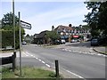
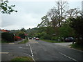
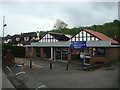
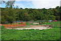
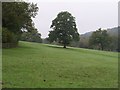
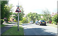
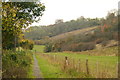
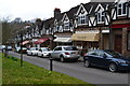
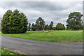

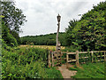
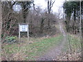
58 photos from this area
Area Information
Key information about the CR5 3ND including its size, population, and administrative classification.
- Area Type
- Postcode
- Area Size
- 2.1 hectares
- Population
- 1480
- Population Density
- 1365 people/km²
House Prices in CR5 3ND
18
Properties
£489,332
Average Sold Price
£149,000
Lowest Price
£820,000
Highest Price
Showing 18 properties
| Address | Type | Beds | Baths | Last Sale Price | Last Sale Date | |
|---|---|---|---|---|---|---|
| 68 Outwood Lane, Chipstead, CR5 3ND | Detached | 4 | 2 | £463,980 | Nov 2025 | |
| 98 Outwood Lane, Chipstead, CR5 3ND | Detached | 5 | 3 | £820,000 | Jul 2023 | |
| 90 Outwood Lane, Chipstead, CR5 3ND | Detached | 4 | 2 | £770,000 | Apr 2022 | |
| 80 Outwood Lane, Chipstead, CR5 3ND | house | - | - | £760,000 | Jun 2021 | |
| 100 Outwood Lane, Chipstead, CR5 3ND | Detached | 4 | 2 | £625,000 | Dec 2018 | |
| 86 Outwood Lane, Chipstead, CR5 3ND | Semi-detached | 3 | 1 | £500,000 | Jun 2016 | |
| 70 Outwood Lane, Chipstead, CR5 3ND | Detached | 4 | 2 | £630,000 | Dec 2015 | |
| 74 Outwood Lane, Chipstead, CR5 3ND | Bungalow | 4 | 3 | £345,000 | Sep 2006 | |
| 88 Outwood Lane, Chipstead, CR5 3ND | Detached | - | - | £345,000 | Mar 2006 | |
| 92 Outwood Lane, Chipstead, CR5 3ND | Detached | - | - | £278,000 | Dec 2000 |
Page 1 of 2
Energy Efficiency in CR5 3ND
Amenities
Schools
| Rank | School | Type | Entry gender | Ages |
|---|
Explore more schools in this area
Go to Schools tabDemographics
Household Size
Two person
most common
Accommodation Type
Houses
most common
Tenure
88
majority
Ethnic Group
White
most common
Religion
N/A
most common
Household Composition
N/A
most common
Age
47
median
Adults (30-64 years)
most common
Household Deprivation
N/A
with no deprivation
NS-SEC
49
in Lower managerial occupations
Explore more demographic insights in this area
Go to Demographics tabPlanning
Planning Constraints
- Flood RiskPremium
- Ramsar Wetland SitesPremium
- Area of Outstanding Natural BeautyPremium
- Protected Nature ReservePremium
- Protected WoodlandPremium