Area Overview for CR5 2PZ
Photos of CR5 2PZ

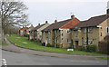
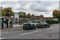
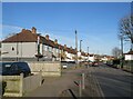
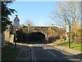
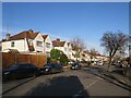
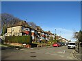
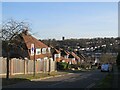
40 photos from this area
Area Information
Key information about the CR5 2PZ including its size, population, and administrative classification.
- Area Type
- Postcode
- Area Size
- 3.5 hectares
- Population
- 1470
- Population Density
- 1547 people/km²
House Prices in CR5 2PZ
8
Properties
£457,800
Average Sold Price
£198,000
Lowest Price
£690,000
Highest Price
Showing 8 properties
| Address | Type | Beds | Baths | Last Sale Price | Last Sale Date | |
|---|---|---|---|---|---|---|
| 62 The Mount, Coulsdon, CR5 2PZ | Semi-detached | 4 | 3 | £651,000 | Jul 2024 | |
| Owls House, 68 The Mount, Coulsdon, CR5 2PZ | house | - | - | £690,000 | Sep 2021 | |
| 66 The Mount, Coulsdon, CR5 2PZ | Semi-detached | 4 | 1 | £520,000 | Sep 2020 | |
| 64 The Mount, Coulsdon, CR5 2PZ | house | - | - | £230,000 | Feb 2005 | |
| 60 The Mount, Coulsdon, CR5 2PZ | Semi-detached | - | - | £198,000 | May 2002 | |
| Tennis Courts, Corrigan Recreation Ground, Corrigan Avenue, Coulsdon, CR5 2PZ | Leisure | - | - | - | - | |
| Tennis 18M From 68 The Mount 28M From Unnamed Road, The Mount, Coulsdon, CR5 2PZ | Leisure | - | - | - | - | |
| 58 The Mount, Coulsdon, CR5 2PZ | Semi-detached | - | - | - | - |
Energy Efficiency in CR5 2PZ
Amenities
Schools
| Rank | School | Type | Entry gender | Ages |
|---|
Explore more schools in this area
Go to Schools tabDemographics
Household Size
Family (3-5 people)
most common
Accommodation Type
Houses
most common
Tenure
90
majority
Ethnic Group
White
most common
Religion
N/A
most common
Household Composition
N/A
most common
Age
47
median
Adults (30-64 years)
most common
Household Deprivation
N/A
with no deprivation
NS-SEC
41
in Lower managerial occupations
Explore more demographic insights in this area
Go to Demographics tabPlanning
Planning Constraints
- Flood RiskPremium
- Ramsar Wetland SitesPremium
- Area of Outstanding Natural BeautyPremium
- Protected Nature ReservePremium
- Protected WoodlandPremium