Area Overview for CR3 9YR
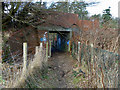
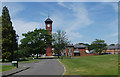
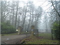
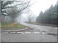
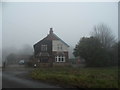
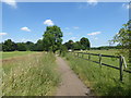
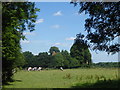
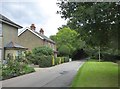
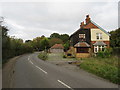
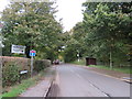
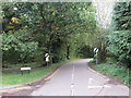
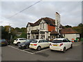
Photos of CR3 9YR
Area Information
CR3 9YR is a small residential postcode in Surrey, nestled within the Metropolitan Green Belt, approximately 15 miles south of London. It lies in the civil parish of Chelsham and Farleigh, a rural area with a population of 1,942 people spread across 1,500 hectares of open countryside. The area’s low density—just 124 people per square kilometre—reflects its designation as Green Belt land, preserving its rural character. Historically, Chelsham and Farleigh were two distinct villages unified in 1969, with a legacy of Anglo-Saxon origins and medieval manors. Today, the area balances its pastoral roots with proximity to suburban developments like New Addington and Croydon. Residents benefit from natural features such as Great Farleigh Wood and Selsdon Nature Reserve, while the nearby towns of Warlingham and Woldingham offer essential services. The postcode’s compact size and low population mean it retains a quiet, community-focused atmosphere, though its location near urban sprawl necessitates vigilance to protect its rural identity.
- Area Type
- Postcode
- Area Size
- Not available
- Population
- 1942
- Population Density
- 124 people/km²
CR3 9YR is primarily an owner-occupied area, with 67% of residents living in their own homes. The accommodation type is predominantly houses, a feature typical of rural and semi-rural Surrey. This contrasts with urban areas where flats or apartments dominate, and suggests a focus on family homes and larger properties. The low population density—124 people per square kilometre—means the housing stock is spread out, with each house occupying a significant portion of the land. For buyers, this implies limited availability of properties within the postcode itself, with potential interest in nearby areas such as Warlingham or Woldingham. The high home ownership rate indicates a stable market, though the small size of the area may limit options for those seeking a wider selection. Prospective buyers should consider the proximity to urban centres for more extensive property choices, while still benefiting from the rural setting of CR3 9YR.
House Prices in CR3 9YR
No properties found in this postcode.
Energy Efficiency in CR3 9YR
CR3 9YR offers a mix of retail, transport, and recreational amenities within practical reach. Nearby shops include Sainsburys Warlingham, Tesco Warlingham, and Co-op Hamsey, providing essential grocery and household services. The area’s tram network, with stops like New Addington Tram Stop and Fieldway Tram Stop, connects residents to larger towns and London. Railway stations such as Woldingham and Whyteleafe South offer further commuting options. For leisure, the proximity to Selsdon Nature Reserve and Great Farleigh Wood provides opportunities for walking, cycling, and wildlife observation. The presence of Farleigh Court Golf Course and historic sites like St Mary’s Church adds cultural and recreational value. While the area’s rural character limits large-scale commercial hubs, the combination of local shops, transport links, and natural spaces supports a self-sufficient lifestyle with easy access to urban amenities.
Amenities
Schools
The nearest school to CR3 9YR is Warlingham Park School, an independent institution with an Ofsted rating of satisfactory. Independent schools typically offer smaller class sizes and specialist facilities, though their fees can be higher than state schools. This single listed school suggests limited options for families within the immediate area, necessitating a commute to nearby towns such as Warlingham or Woldingham for additional educational choices. The presence of an independent school may appeal to parents seeking alternative education models, though the lack of state school options could be a consideration for those prioritising affordability or proximity. Families should evaluate the school’s performance in detail, using Ofsted reports to assess its suitability for their children’s needs.
| Rank | School | Type | Entry gender | Ages |
|---|
Explore more schools in this area
Go to Schools tabDemographics
CR3 9YR has a median age of 47, with the majority of residents aged 30–64. This suggests a mature, stable population, likely comprising families and professionals seeking a quieter lifestyle. Home ownership is high at 67%, indicating a strong preference for long-term residency over renting. The accommodation type is predominantly houses, reflecting the area’s rural and semi-rural character, which contrasts with denser urban zones. The predominant ethnic group is White, aligning with broader trends in Surrey’s less densely populated regions. The low population density—124 people per square kilometre—means the area is not heavily populated, contributing to a sense of space and privacy. However, the limited diversity in demographics may affect the range of community activities and services. The age profile suggests a community with established roots, potentially influencing local traditions and social structures.
Household Size
Accommodation Type
Tenure
Ethnic Group
Religion
Household Composition
Age
Household Deprivation
NS-SEC
Explore more demographic insights in this area
Go to Demographics tabPlanning
Planning Constraints
- Flood RiskPremium
- Ramsar Wetland SitesPremium
- Area of Outstanding Natural BeautyPremium
- Protected Nature ReservePremium
- Protected WoodlandPremium