Area Overview for CR3 6HF
Photos of CR3 6HF
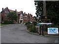
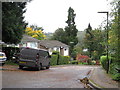
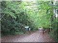
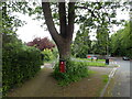
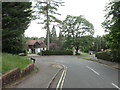
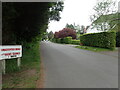
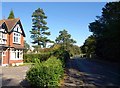
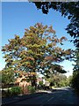

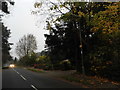

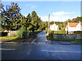
23 photos from this area
Area Information
Key information about the CR3 6HF including its size, population, and administrative classification.
- Area Type
- Postcode
- Area Size
- 2.0 hectares
- Population
- 1720
- Population Density
- 3358 people/km²
House Prices in CR3 6HF
40
Properties
£642,800
Average Sold Price
£249,000
Lowest Price
£1,030,000
Highest Price
Showing 40 properties
| Address | Type | Beds | Baths | Last Sale Price | Last Sale Date | |
|---|---|---|---|---|---|---|
| 106 Harestone Valley Road, Caterham, CR3 6HF | Detached | 4 | 2 | £950,000 | Jun 2025 | |
| 104 Harestone Valley Road, Caterham, CR3 6HF | Detached | 4 | 1 | £1,030,000 | Dec 2017 | |
| 100 Harestone Valley Road, Caterham, CR3 6HF | Detached | 3 | - | £685,000 | Feb 2016 | |
| 110 Harestone Valley Road, Caterham, CR3 6HF | Detached | - | - | £300,000 | Jul 1999 | |
| 108 Harestone Valley Road, Caterham, CR3 6HF | Detached | - | - | £249,000 | Jun 1995 | |
| 13, Richmond House, 86 Harestone Valley Road, Caterham, CR3 6HF | Flat | 2 | 1 | - | - | |
| 12, Richmond House, 86 Harestone Valley Road, Caterham, CR3 6HF | Flat | 2 | 1 | - | - | |
| 6, Richmond House, 86 Harestone Valley Road, Caterham, CR3 6HF | Flat | 2 | 1 | - | - | |
| 2, Silvermere Court, 88 Harestone Valley Road, Caterham, CR3 6HF | Flat | 2 | 1 | - | - | |
| 4, Richmond House, 86 Harestone Valley Road, Caterham, CR3 6HF | Flat | 2 | 1 | - | - |
Page 1 of 4
Energy Efficiency in CR3 6HF
Amenities
Schools
| Rank | School | Type | Entry gender | Ages |
|---|
Explore more schools in this area
Go to Schools tabDemographics
Household Size
Two person
most common
Accommodation Type
Flats
most common
Tenure
63
majority
Ethnic Group
White
most common
Religion
N/A
most common
Household Composition
N/A
most common
Age
47
median
Adults (30-64 years)
most common
Household Deprivation
N/A
with no deprivation
NS-SEC
49
in Lower managerial occupations
Explore more demographic insights in this area
Go to Demographics tabPlanning
Planning Constraints
- Flood RiskPremium
- Ramsar Wetland SitesPremium
- Area of Outstanding Natural BeautyPremium
- Protected Nature ReservePremium
- Protected WoodlandPremium