Area Overview for CR3 3YN
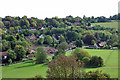
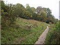
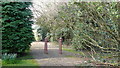
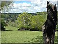
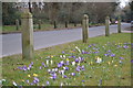
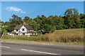
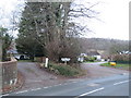
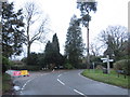
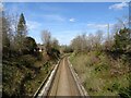
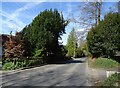
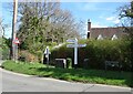
Photos of CR3 3YN

Area Information
Living in CR3 3YN means residing within a small residential cluster that forms part of the larger Chipstead, Kingswood & Woodmansterne ward. This specific postcode sector sits on the North Downs, bordering Greater London and行政村 under the Reigate and Banstead Borough Council. The area encompasses a population of 1,660 people across a landscape shaped by ancient history, including Woodmansterne, which was recorded in the Domesday Book of 1086 as Odemerestor. While the rest of Surrey has expanded significantly, CR3 3YN retains the character of a quiet village environment where modern homeowners live amidst historic landmarks like St Margaret's Church and the remnants of the Chipstead Valley Railway. The village was established by Richard de Tonebrige, who held assets including a mill and wood, and later incorporated into estates such as Kingswood Warren, a Saxon-era enclave possibly serving as a royal game preserve. For prospective buyers, this location offers a blend of rural tranquillity and practical access to London. The village centre features revitalised buildings like the Chipstead School Mews art gallery, which occupies the site of the former primary school that closed in 1994. The area sits within an affluent corridor linked to former limestone quarries and landed gentry, such as the Jolliffe Barons, ensuring a stable, established community feel. Residents enjoy a low population density of 195 people per square kilometre, providing space without total isolation.
- Area Type
- Postcode
- Area Size
- Not available
- Population
- 1660
- Population Density
- 195 people/km²
The property market in CR3 3YN is characterised by a predominantly owner-occupied housing stock where 90% of households own their accommodation. This statistic reflects a market where properties are often held by families who have lived in the village for decades rather than by investors buying for short-term rentals. Because the area consists almost exclusively of houses, buyers looking for flats or modern apartment complexes will not find them within this specific postcode sector. Instead, the local market comprises the traditional stock of the North Downs villages, which includes period homes linked to the historic estates of Kingswood Warren and Hylton. For those seeking homes in CR3 3YN, the 195 people per square kilometre population density indicates spacious living conditions without the congestion of the main commuter belts. The high rate of home ownership suggests that sellers here are either deceased estate representatives or long-term residents releasing properties, rather than corporate landlords. This dynamic often results in a slower, more deliberate sales process compared to high-turnover rental zones. The area attracts buyers who value stability and prefer to settle in a community with deep roots in the historic landscape of Surrey.
House Prices in CR3 3YN
No properties found in this postcode.
Energy Efficiency in CR3 3YN
Daily life in CR3 3YN revolves around the convenience of five major amenities clusters located within easy reach. Residents have access to five prominent retail outlets, including Budgens Coulsdon, Tesco Coulsdon, and Aldi Coulsdon, ensuring that grocery needs are met without a long journey into urban centres. For those who prefer rail travel over driving, five nearby rail stations facilitate day-to-day mobility, while five metro stops, such as Wandle Park Tram Stop, provide further connectivity options for leisure or emergency travel. These amenities are the backbone of village life here, allowing residents to handle most shopping and transport needs locally. The area is also rich in historical and recreational culture that enhances the quality of life. Visitors can explore historic sites like St Margaret's Church, built with ties to Rector John Tattersall dating back to 1718, or enjoy the natural settings of the North Downs. The proximity to venues like Kingswood Village Hall, built in 1926, offers community spaces for events and gatherings. This blend of modern retail convenience and deep historical heritage creates a lifestyle where practical needs are easily met alongside an appreciation for the village's ancient character.
Amenities
Schools
Families considering CR3 3YN have access to two notable educational institutions nearby, providing a mix of academic and specialised support options. Chipstead First School operates as a primary school serving families with younger children. For residents requiring special education, Serenity School is a nearby specialist facility that holds an outstanding Ofsted rating, indicating very high standards of care and teaching within the special needs sector. This combination ensures that children of varying abilities can access an appropriate education within commuting distance of the village. The presence of these specific schools means that parents in CR3 3YN do not need to travel far to secure school places. The mix of a standard primary provider and a highly rated special school suggests a community that caters to diverse educational needs. While the data does not list secondary schools for this immediate sector, the availability of these two key institutions places CR3 3YN on the doorstep of specialist education. Schools near CR3 3YN therefore offer a direct, local solution for families prioritising proximity and quality in their school choices.
| Rank | School | Type | Entry gender | Ages |
|---|
Explore more schools in this area
Go to Schools tabDemographics
The community in CR3 3YN is defined by a mature demographic profile with a median age of 47 years. The most common age range for residents spans from 30 to 64 years, indicating a population dominated by adults in their earning households rather than young singles or very elderly retirees. This age distribution contributes to a stable neighbourhood where residents have likely settled permanently rather than moving frequently for short-term trends. Home ownership stands at 90%, creating a community where 9 out of 10 households own their properties outright or with a mortgage. This high level of ownership typically correlates with long-term stability and a strong sense of local investment in the area's upkeep and appearance. Accommodation in CR3 3YN consists almost entirely of houses, reflecting the village-centric nature of the living environment rather than the apartments or bungalows found in urban sprawls. The predominant ethnic group is White, which aligns with the historical Anglo-Saxon and Victorian expansion of this part of Surrey. There are no significant gaps in the data regarding deprivation, allowing for a clear picture of a middle-to-upper-income market. The low crime risk score of 79 out of 100 further confirms that this is a secure environment where residents feel comfortable outside their homes. Living in CR3 3YN means joining a settled, owner-occupied community where households are likely to know their neighbours well.
Household Size
Accommodation Type
Tenure
Ethnic Group
Religion
Household Composition
Age
Household Deprivation
NS-SEC
Explore more demographic insights in this area
Go to Demographics tabPlanning
Planning Constraints
- Flood RiskPremium
- Ramsar Wetland SitesPremium
- Area of Outstanding Natural BeautyPremium
- Protected Nature ReservePremium
- Protected WoodlandPremium