Area Overview for Cox Green
Photos of Cox Green


Area Information
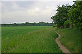
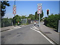
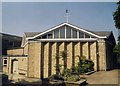
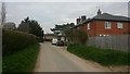
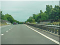
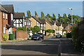
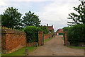
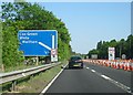
Cox Green sits quietly as a civil parish within the Chilterns, covering an area of just 5.0 km². Despite its modest footprint, the village accommodates 1,490 residents, creating a density of 298 people per square kilometre. This compact size gives the community a intimate feel where neighbours know each other, yet it remains part of the broader Buckinghamshire landscape. Living in Cox Green means enjoying a rural setting without being cut off from essential services, as the parish is connected to nearby towns inлоч and Maidenhead. The village benefits from being situated near the A4 road, which provides access to London via the M40 motorway, making it a practical choice for commuters while retaining a village atmosphere. You will find a high proportion of owner-occupiers here, reflecting a community where people have settled down for the long term. Daily life revolves around the high street, the parish church, and local green spaces that define the character of this hamlet. The combination of proximity to major transport links and a small population size offers a balanced lifestyle for families and retirees alike. Homes in Cox Green provide a sense of stability, supported by excellent broadband infrastructure and a low-risk crime environment.
- Area Type
- District Borough Unitary Ward
- Area Size
- 5.0 km²
- Population
- 1490
- Population Density
- 298 people/km²
Demographics
The demographic profile of Cox Green reveals a community defined by maturity and stability. With a median age of 70 years, this is clearly an area favoured by older residents who have put down roots locally. The population density of 298 people per square kilometre indicates a settled village rather than a transient town centre. Home ownership stands at an exceptionally high 79%, which is characteristic of villages where current occupants have accumulated property over decades. This high level of ownership suggests that the housing stock consists largely of long-term residents rather than short-term renters or students. You will not find a youthful demographic of young professionals or recent graduates dominating the scene; instead, the residents are likely families raising children or retirees seeking peace. The household composition reflects traditional family structures or retired couples living independently. There is no indication of significant transient populations or diverse generational mixing found in more urban settings. Living in Cox Green means entering a community where generations have remained close to their homes for many years. The low population density supports a slower pace of life, where daily interactions revolve around local amenities rather than commuter rushes.
Household Size
Accommodation Type
Tenure
Ethnic Group
Religion
Household Composition
Age
Household Deprivation
NS-SEC
Explore more demographic insights in this area
Go to Demographics tabPlanning
Planning Constraints
- Flood RiskLocked
- Ramsar Wetland SitesLocked
- Area of Outstanding Natural BeautyLocked
- Protected Nature ReserveLocked
- Protected WoodlandLocked
- Crime RiskLocked