Area Overview for Cowfold
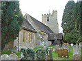
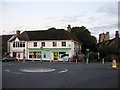
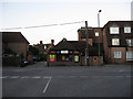
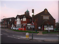
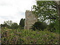
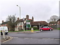
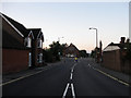
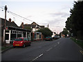
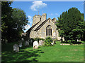
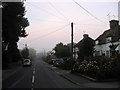
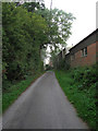
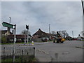
Photos of Cowfold
Area Information
Cowfold is a compact built-up area in England, spanning 48.8 hectares. It is a town or city with a distinct character, shaped by its older population and strong sense of community. The median age of residents is 70, suggesting a demographic skewed towards retirees and long-term residents. This age profile influences the area’s rhythm, with a focus on stability and local amenities. Cowfold’s size means it is walkable, with nearby shops, transport links, and green spaces within practical reach. The high home ownership rate—76% of households own their homes—indicates a settled population, many of whom have lived in the area for years. For buyers, Cowfold offers a quiet, low-maintenance lifestyle, with minimal urban sprawl and a strong emphasis on accessibility. Its proximity to rail stations and good broadband connectivity makes it appealing for those who work remotely or value convenience. While not a bustling commercial hub, Cowfold’s charm lies in its simplicity, making it ideal for those seeking a peaceful, well-connected home.
- Area Type
- Built Up Area 250
- Area Size
- 48.8 hectares
- Population
- Not available
- Population Density
- Not available
Cowfold’s lifestyle is shaped by its proximity to essential amenities. Within practical reach are five retail outlets, including Co-op Cowfold, Co-op Partridge, and Morrisons Daily, offering everyday shopping needs. These shops provide convenience for residents, reducing the need for long trips to larger centres. The two nearby railway stations—Horsham and Christs Hospital—enhance mobility, allowing easy access to broader services and employment opportunities. While the area does not list parks or leisure facilities in the data, the presence of retail and transport options suggests a community focused on practicality over large-scale recreation. The combination of local shops and rail links supports a self-sufficient lifestyle, ideal for those who prefer minimal commuting and easy access to essentials.
Amenities
Schools
The nearest school to Cowfold is St Peter’s CofE (Aided) Primary School, a primary institution with a good Ofsted rating. This single school is the only one explicitly listed in the data, meaning families in the area have limited options for education. The presence of a primary school with a good rating is a positive for parents, though the absence of secondary schools or alternative educational institutions may require families to consider commuting to nearby towns. For those prioritising proximity to schools, Cowfold’s single option may be a drawback, but the quality of the existing school suggests it meets standard educational benchmarks.
| Rank | School | Type | Entry gender | Ages |
|---|
Explore more schools in this area
Go to Schools tabDemographics
Cowfold’s population is predominantly older, with a median age of 70, reflecting a community where retirees form a significant proportion. The data shows 76% of households are owner-occupied, suggesting a stable, long-term resident base. While specific details on household composition or accommodation types are not provided, the high home ownership rate indicates a lack of transient populations. The area’s demographic profile is not defined by diversity in ethnic or religious backgrounds, as the predominant groups are not specified. This does not necessarily imply homogeneity, but the data does not quantify it. The absence of detailed breakdowns on deprivation or income levels means the quality of life is inferred from the safety and connectivity metrics. For instance, the low crime risk and good broadband scores suggest a comfortable living environment, though the older demographic may have different needs compared to younger families.
Household Size
Accommodation Type
Tenure
Ethnic Group
Religion
Household Composition
Age
Household Deprivation
NS-SEC
Explore more demographic insights in this area
Go to Demographics tabPlanning
Planning Constraints
- Crime RiskPremium