Area Overview for Cobham (Elmbridge)
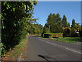
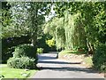
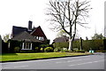
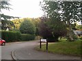
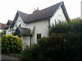
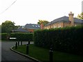
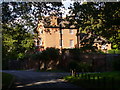
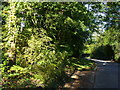
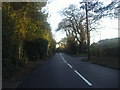
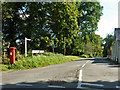
Photos of Cobham (Elmbridge)

Area Information
You are looking at Cobham (Elmbridge), a built-up area defined by its suburban character and established history. This town covers 9.1 km², creating a compact living space for residents who value proximity to services. The population profile suggests an older demographic, with a median age of 70. This indicates that Cobham (Elmbridge) is a retirement-friendly location where stable, mature families and empty nesters likely dominate the community. Daily life here revolves around a quiet, established neighbourhood rather than a fast-paced urban centre. You will find that the area functions as a modest town within the wider Elmbridge borough, offering convenience without the noise of a city centre. The population density is moderate for a built-up area, allowing residents to enjoy green space and a slower pace while remaining connected to the wider region. Living in Cobham (Elmbridge) means choosing an environment where the primary attractions are community stability and reliable access to local amenities rather than large-scale commercial development. The area's size ensures that you can walk or cycle to many local facilities without needing a vehicle for every errand.
- Area Type
- Built Up Area 250
- Area Size
- 9.1 km²
- Population
- Not available
- Population Density
- Not available
Daily life in Cobham (Elmbridge) is enhanced by a cluster of essential amenities within practical reach. You have five railway links nearby, including Oxshott Railway Station, Cobham & Stoke d'Abernon Railway Station, and Claygate Railway Station, providing efficient rail access to the wider region. For shopping needs, the town centre offers five major retail outlets. Sainsburys Cobham, Waitrose Cobham, and Sainsburys Cobham collectively offer a wide range of groceries and household goods, reducing the need for long trips elsewhere. You can easily pick up fresh produce, unpackaged items, and everyday essentials without leaving the town bounds. Ferry links are also accessible, with five options including Weybridge Ferry Crossing, Ditton Island Ferry Landing, and Shepperton Ferry Landing. These vessels provide scenic routes to Surrey and London if you prefer water transport. The combination of rail, road, and ferry options ensures that your commute or weekend getaway is flexible. Shops like Waitrose offer additional conveniences such as delis and restaurants, adding a touch of lifestyle variety to the retail experience. You find that the amenities are sufficient for a self-contained town life while remaining close to the vibrancy of larger centres like Weybridge if desired.
Amenities
Schools
Education options near Cobham (Elmbridge) offer a distinct mix of state and private provision, catering to diverse family needs. You have several primary schools close by, including The Royal Kent CofE Primary School, which holds a 'good' Ofsted rating. Nearby is St Andrew's CofE Primary School, providing another state alternative for local children. Beyond the state sector, the town offers access to several independent institutions. Reeds School and Danes Hill School are prominent independent options serving different educational philosophies. Additionally, ACS Cobham International School is available for those seeking an international curriculum. The presence of these schools means that families living in Cobham (Elmbridge) can choose between a high-performing state education or the bespoke environment of an independent school. This variety appeals to different budgets and educational priorities. You will find that the school catchment areas blend seamlessly with the residential zones, making schooling a natural part of daily life. Whether you prefer a traditional Church of England primary or an elite independent prep, the local landscape supports your choice without requiring a commute to distant towns.
| Rank | School | Type | Entry gender | Ages |
|---|
Explore more schools in this area
Go to Schools tabDemographics
The community in Cobham (Elmbridge) reflects a settled population where long-term residency is the norm. You will find that 72% of households own their homes, signaling a stable market where residents are not transient but deeply rooted in the locality. This high ownership rate contrasts sharply with volatile rental markets elsewhere, offering you peace of mind regarding neighbour consistency and security of tenure. The age profile tells a clear story; with a median age of 70, Cobham (Elmbridge) caters primarily to older adults nearing retirement or already retired. This demographic concentration shapes the local culture and demand for services, favouring healthcare, quiet environments, and community groups over nightclub culture or intensive childcare facilities. While the data does not specify ethnicity or religious breakdowns, the homogeneity suggested by the age and ownership figures implies a relatively uniform community fabric. Deprivation metrics are not explicitly detailed in the current records, but the high home ownership rate and older-than-average age generally correlate with areas of lower economic pressure. When considering homes in Cobham (Elmbridge), you are looking at a place where social stability outweighs rapid change.
Household Size
Accommodation Type
Tenure
Ethnic Group
Religion
Household Composition
Age
Household Deprivation
NS-SEC
Explore more demographic insights in this area
Go to Demographics tabPlanning
Planning Constraints
- Crime RiskPremium