Area Overview for Cliffsend
Photos of Cliffsend


Area Information
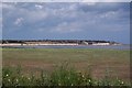
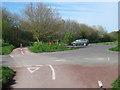
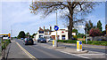
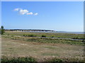
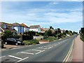
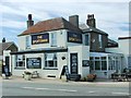
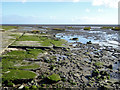
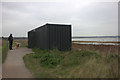
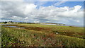
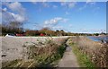
Living in Cliffsend means residing within a small civil parish that sits just two miles west of Ramsgate in Kent. This settlement occupies a coastline of four square kilometres on the southern edge of the Isle of Thanet, placing you approximately 300 metres from the shoreline of Pegwell Bay. The area possesses ancient roots, with archaeological evidence from the Bronze Age and significant Anglo-Saxon history linking it to the arrival of Hengist and Horsa. St Augustine's Cross still stands as a memorial to the 597 AD arrival of St Augustine. Today, the village functions as a quiet residential community where daily life revolves around local amenities such as the Post Office, the Village Hall, and the Sportsman Inn pub. You can visit the nearby Pegwell Bay Country Park to view a replica Viking longship on the cliff top. With a population of roughly 1,889, Cliffsend offers a distinctly village atmosphere where residents benefit from proximity to the sea and historical sites without the density of larger towns. The area remains a straightforward choice for those seeking a specific type of coastal existence within the Thanet district.
- Area Type
- Parish
- Area Size
- 4.0 km²
- Population
- Not available
- Population Density
- Not available
Demographics
The community in Cliffsend demonstrates a clear trend toward older residents. The median age here is 70 years, meaning half the population is older than this figure. This demographic profile aligns with the high level of home ownership, which stands at 90% of all households. Such figures indicate a neighbourhood where long-term residents have likely stayed for decades, creating a stable local environment. The data does not specify the most common age range beyond the total count, but the median age strongly suggests that families with young children are less common than retired couples or single older individuals. Although specific figures for household composition, accommodation types, predominant ethnic groups, and religion are not detailed in the available records, the 90% ownership rate provides a strong economic signal for the area. Deprivation data is not included in the current information, so you cannot assess social mobility or income distribution directly. However, the age structure and ownership levels paint a picture of a settled, mature community where property is rarely bought and sold rapidly.
Household Size
Accommodation Type
Tenure
Ethnic Group
Religion
Household Composition
Age
Household Deprivation
NS-SEC
Explore more demographic insights in this area
Go to Demographics tabPlanning
Planning Constraints
- Flood RiskPremium
- Ramsar Wetland SitesPremium
- Area of Outstanding Natural BeautyPremium
- Protected Nature ReservePremium
- Protected WoodlandPremium
- Crime RiskPremium