Area Overview for Clewer & Dedworth East Ward
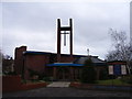
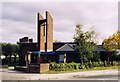
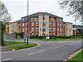
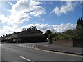
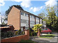
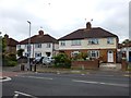
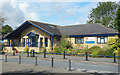
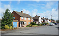
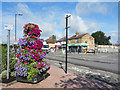
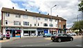
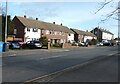
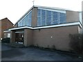
Photos of Clewer & Dedworth East Ward
Area Information
Living in Clewer & Dedworth East Ward offers a defined slice of life within the Royal Borough of Windsor and Maidenhead. This electoral ward sits in Berkshire, South East England, and forms part of the larger Windsor UK Parliament constituency. The area covers a specific 3.6 km², creating a relatively compact environment for residents. Your daily life here is shaped by well-known locations such as Mill Lane, North Close, Paddock Close, Rays Avenue, and Rutherford Close. These streets define the immediate neighbourhood where you will commute, walk, or tend to your garden. The ward's central coordinates at 51.4755°N, 0.6419°W place it within a recognised geographical boundary that influences local governance and services. You are looking at a section of Clewer and Dedworth that balances suburban residential streets with proximity to broader regional hubs. The area functions as a distinct residential unit rather than a sprawling expanse. When you consider your future home, you are choosing a location embedded in the established fabric of the South East. This ward provides a specific postcode environment where the rhythm of life is dictated by the scale of the land and the organisation of the streets. You will navigate a neighbourhood that is bounded and purposeful, offering clear boundaries for where you live and where the wider town begins.
- Area Type
- District Borough Unitary Ward
- Area Size
- 3.6 km²
- Population
- Not available
- Population Density
- Not available
Demographics
The community profile in Clewer & Dedworth East Ward reveals a distinct age demographic. The median age reaches 70 years, indicating a population significantly older than the national average. Most of the residents fall within the older age brackets, with the majority over the years of 70 shape the social fabric. This concentration of older adults suggests a neighbourhood suitable for retirees or those seeking a quieter, less juvenile environment. Sixty per cent of households hold a home ownership status, while the remainder tend towards renting. This high ownership rate provides stability and a strong sense of territorial engagement among the people you meet. The data does not specify a predominant ethnic group or religious breakdown in the current records, so the composition reflects a general mix typical of its administrative region. Accommodation types vary across the 3.6 km², but the ownership figure dominates the landscape. You can expect to live among a demographic that values security and permanence. The area feels settled because the majority of inhabitants are the owners of their homes. This means that when you move here, you enter a community where long-term commitment is the norm. Deprivation data is not listed in the provided figures, so any assessment of local affluence relies on the proxy of high home ownership. The age profile alone suggests a community focused on later life stages, retirements, and the transitions accompanying them. When you visit a shop or a pub in this ward, you are likely engaging with neighbours who have called this place home for decades. Their concerns, routines, and expectations will align with a mature, established population rather than a rapidly shifting workforce.
Household Size
Accommodation Type
Tenure
Ethnic Group
Religion
Household Composition
Age
Household Deprivation
NS-SEC
Explore more demographic insights in this area
Go to Demographics tabPlanning
Planning Constraints
- Flood RiskPremium
- Ramsar Wetland SitesPremium
- Area of Outstanding Natural BeautyPremium
- Protected Nature ReservePremium
- Protected WoodlandPremium
- Crime RiskPremium