Area Overview for Clayhill
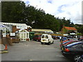
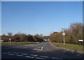
Photos of Clayhill


Area Information
Clayhill is a compact built-up area in England, spanning 95.6 hectares. Its population, though not explicitly stated, is likely modest given its size, and the median age of 70 suggests a community skewed toward older residents. This area is not a sprawling city but a focused, practical settlement, with amenities and transport links designed for accessibility. Daily life here is shaped by its proximity to High Wycombe and surrounding towns, offering a balance between rural tranquillity and urban convenience. The presence of Wycombe Air Park, just one notable airport nearby, hints at a connection to regional travel networks. For those seeking a quieter lifestyle, Clayhill’s smaller footprint and established infrastructure cater to residents prioritising stability over fast-paced urban living. Its rail connections—five stations including High Wycombe and Marlow—provide direct links to London and beyond, making it a viable option for commuters. The area’s character is defined by its practicality, with a focus on essential services and connectivity rather than sprawling development.
- Area Type
- Built Up Area 250
- Area Size
- 95.6 hectares
- Population
- Not available
- Population Density
- Not available
Clayhill’s lifestyle is shaped by its proximity to essential amenities. Within practical reach are five retail outlets, including Asda High, Tesco High, and Aldi Crest Road, offering everyday shopping needs. The area’s rail network, with five stations such as High Wycombe and Marlow, provides easy access to regional transport, facilitating travel to larger towns and cities. The Wycombe Air Park, though not a major airport, adds to the area’s connectivity. For leisure, the rail links and nearby towns offer cultural and recreational options. The presence of multiple stations also supports a commuter lifestyle, allowing residents to balance local living with opportunities elsewhere. The practical reach of these amenities means daily life in Clayhill is convenient, though the lack of detailed data on parks or leisure facilities leaves gaps in understanding the area’s recreational offerings.
Amenities
Schools
| Rank | School | Type | Entry gender | Ages |
|---|
Explore more schools in this area
Go to Schools tabDemographics
Clayhill’s population has a median age of 70, the highest in the dataset, indicating a predominantly older demographic. This suggests a community where retirees or long-term residents form the majority. Home ownership is high at 76%, reflecting a stable, established population with fewer renters. The data does not specify household composition or accommodation types, but the overall figures imply a mix of family homes and single-occupancy properties. The absence of detailed diversity metrics means the area’s ethnic and religious composition remains unspecified. However, the age profile and ownership rates suggest a mature, settled community with limited turnover. For buyers, this demographic may translate to a quieter, less transient environment, though it also raises questions about the availability of family-friendly housing or newer developments. The area’s character is shaped by its older residents, with services and amenities tailored to their needs.
Household Size
Accommodation Type
Tenure
Ethnic Group
Religion
Household Composition
Age
Household Deprivation
NS-SEC
Explore more demographic insights in this area
Go to Demographics tabPlanning
Planning Constraints
- Crime RiskPremium