Area Overview for Claygate
Photos of Claygate


Area Information
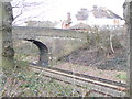
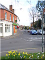
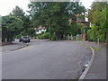
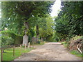
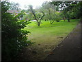
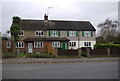
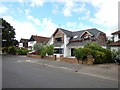
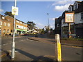
Claygate is a small civil parish and village located in the Elmbridge district of Surrey, covering an area of 4.7 km². The locality derives its name from the clay pits that historically supplied brick-making industries used to construct landmarks such as Hampton Court Palace. Today, the village sits at the edge of London Clay deposits, serving as a gateway to these geological belts surrounding Greater London. Residents enjoy a quintessential English village atmosphere that remains distinct from the surrounding urban sprawl. You will find a genuine sense of isolation here, as the village lacks main roads and relies on only three access routes. Despite being part of the bustling Surrey commuter belt, Claygate retains the character of a quiet oasis. Homes in Claygate offer a retreat from pace of larger towns while maintaining reasonable connections to wider transport networks. The village is bordered by Esher to the north and west and historically formed part of the Thames Ditton parish. This unique positioning provides a specific lifestyle for those seeking a neighbourhood defined by history and tranquility rather than modern urban convenience.
- Area Type
- District Borough Unitary Ward
- Area Size
- 4.7 km²
- Population
- Not available
- Population Density
- Not available
Demographics
The community profile of Claygate reflects a stable, established population with a median age of 70 years. This high average indicates that the village is home to a predominantly older demographic compared to national averages. Broad data categorises household composition and ethnicity totals without specifying the breakdowns, confirming the area lacks detailed statistics on these specific metrics within the provided research. You should understand that the local population is mature, suggesting a quieter social environment suited to retirement living or families with older children. Home ownership stands at an impressive 81%, demonstrating that most residents have purchased their properties rather than renting. This figure signals a deeply rooted local community where families and individuals have invested in homes in the area for the long term. The high percentage of owner-occupiers suggests stability and a strong attachment to the location. Accommodation types are recorded in total form, indicating that while specific tenure splits exist, the overall stock is dominated by owned properties. Deprivation is not quantified in the available data, but the age profile and ownership rates suggest a middle-to-upper income bracket typical of Surrey villages.
Household Size
Accommodation Type
Tenure
Ethnic Group
Religion
Household Composition
Age
Household Deprivation
NS-SEC
Explore more demographic insights in this area
Go to Demographics tabPlanning
Planning Constraints
- Flood RiskPremium
- Ramsar Wetland SitesPremium
- Area of Outstanding Natural BeautyPremium
- Protected Nature ReservePremium
- Protected WoodlandPremium
- Crime RiskPremium