Area Overview for Chislet
Photos of Chislet
Area Information
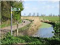
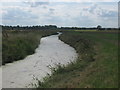
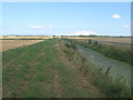
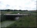
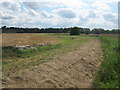
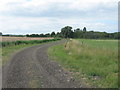
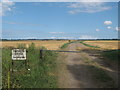
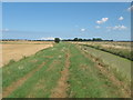
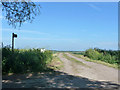
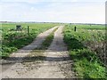
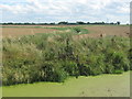
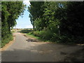
Chislet is a civil parish located in northeast Kent, situated between Canterbury and the Isle of Thanet. This settlement covers an area of 17.3 km² and serves as the western end of the Wantsum Channel, an arm of the North Sea that historically separated the Isle of Thanet from the mainland. The name derives from Old English cistelet, meaning a chestnut copse, a spelling recorded in the Domesday Book. Most of the land use within this parish is agricultural, though marshes are found in low-lying areas. Living in Chislet offers a connection to this history, with the site of the original Manor granted by King Ethelbert to Saint Augustine on 7 January 605. The physical character of the area is defined by the Grade I listed parish church of St Mary the Virgin. This predominantly Norman building dates to the 12th century and underwent major renovation in 1866. You will also find the site of Chislet Windmill, which dates to 1765. Although the original structure was destroyed by fire in 2005, a replica exterior now stands on the same location during a housing redevelopment. The community is anchored by the Grove Ferry Public House, where lavender was historically grown on the surrounding land. While the economy has shifted from coal mining, which peaked at Chislet Colliery in 1918, to agriculture today, the area retains its distinct rural identity. Students looking at schools near Chislet should note the parish is within the Canterbury local government district, while commuters may find themselves in the North Thanet parliamentary constituency.
- Area Type
- Parish
- Area Size
- 17.3 km²
- Population
- Not available
- Population Density
- Not available
Demographics
The community profile in Chislet reflects a mature population structure. The median age for individuals is 70, making the older age demographic the most common group. This data indicates a residential base that is generally settled rather than young. Households in the parish are traditional, with 84% of residents owning their homes outright or with a mortgage. This high rate of home ownership suggests that most people in the area have long-term roots rather than moving frequently for short-term rental purposes. Home ownership figures contrast with areas dominated by private landlords or student housing. The accommodation types available reflect this stable demographic, comprising territory primarily suited to families and seniors. While specific data on household composition by size is not detailed, the high ownership rate implies a lower turnover rate and deeper community bonds. Ethnic diversity and religious affiliation data are aggregated at a total level, meaning specific breakdowns are not available in the current records. Deprivation levels are not quantified here, but the high percentage of owner-occupied properties often correlates with community stability. If you are considering living in Chislet, you are looking at a neighbourhood where residents are likely to have stayed for generations. The demographics paint a picture of a quiet, established community rather than a transient student hub or a rapidly developing commuter belt.
Household Size
Accommodation Type
Tenure
Ethnic Group
Religion
Household Composition
Age
Household Deprivation
NS-SEC
Explore more demographic insights in this area
Go to Demographics tabPlanning
Planning Constraints
- Flood RiskPremium
- Ramsar Wetland SitesPremium
- Area of Outstanding Natural BeautyPremium
- Protected Nature ReservePremium
- Protected WoodlandPremium