Area Overview for Chipstead and Woodmansterne
Photos of Chipstead and Woodmansterne


Area Information
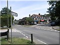
Chipstead and Woodmansterne is a compact built-up area spanning 2.3 km², located in England. Its population, while not specified in exact numbers, is defined by a median age of 70, suggesting a community skewed towards older residents. This area is characterised by a high rate of home ownership, with 84% of residents living in properties they own. Daily life here is shaped by proximity to essential services, including five rail stations such as Chipstead and Woodmansterne, and a range of retail outlets like Tesco and Aldi in nearby Coulsdon. The presence of Woodmansterne Primary School and Serenity School, which holds an outstanding Ofsted rating, underscores the area’s appeal for families. Living in Chipstead and Woodmansterne offers a blend of practicality and accessibility, with amenities within easy reach. The area’s relatively low crime risk, combined with strong digital connectivity, makes it a viable option for those seeking a stable, well-serviced neighbourhood.
- Area Type
- Built Up Area 250
- Area Size
- 2.3 km²
- Population
- Not available
- Population Density
- Not available
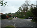
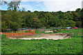
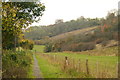
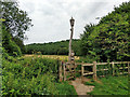
The lifestyle in Chipstead and Woodmansterne is enriched by accessible amenities, including five retail outlets in Coulsdon and three metro stops such as Wandle Park Tram Stop. These facilities provide easy access to shopping, dining, and public transport, supporting both daily errands and leisure activities. The area’s proximity to parks and open spaces, while not explicitly named, is implied by the presence of tram stops near natural areas like Waddon Marsh. The mix of retail, transport, and community-focused services fosters a practical, connected lifestyle, ideal for those valuing convenience without sacrificing proximity to green spaces.
Amenities
Schools
The educational landscape near Chipstead and Woodmansterne includes Woodmansterne Primary School, a primary institution serving the local community. A second Woodmansterne Primary School is also listed, though this may indicate a duplicate entry or a focus on primary education in the area. Serenity School, a special school with an outstanding Ofsted rating, provides tailored education for students with specific needs. The presence of both primary and special schools suggests a comprehensive approach to education, catering to a range of family requirements. For parents, the availability of a high-rated special school alongside primary options offers flexibility, though the absence of secondary schools may necessitate travel for older students.
| Rank | School | Type | Entry gender | Ages |
|---|
Explore more schools in this area
Go to Schools tabDemographics
The demographic profile of Chipstead and Woodmansterne is defined by a median age of 70, indicating a predominantly older population. The most common age range is listed as “Total,” which may reflect aggregated data rather than specific age brackets. Home ownership is exceptionally high at 84%, suggesting a community where most residents live in their own homes. The data does not specify household composition or accommodation types, but the high ownership rate implies a stable, long-term resident base. The predominant ethnic group and religious affiliation are also not detailed, though the absence of specific figures means these aspects cannot be elaborated. The area’s demographic makeup suggests a mature population with established roots, which may influence the character of local services and community dynamics.
Household Size
Accommodation Type
Tenure
Ethnic Group
Religion
Household Composition
Age
Household Deprivation
NS-SEC
Explore more demographic insights in this area
Go to Demographics tabPlanning
Planning Constraints
- Crime RiskPremium