Area Overview for Chiltern Villages Ward
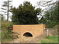
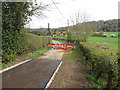
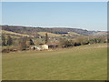
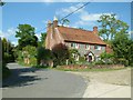
Photos of Chiltern Villages Ward


Area Information
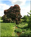
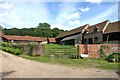
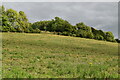
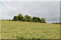
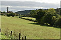
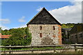
Living in Chiltern Villages Ward offers a distinctly rural experience within Buckinghamshire, a unitary authority in the South East of England. You will find the ward covers a significant expanse of country, with an area size approaching ninety point one square kilometres. The location is defined by its boundaries, situated roughly around the British National Grid coordinates SU 475500,193100, which places it amidst the natural landscape typical of this region. This electoral ward, identified as E05013139, functions as a key administrative unit for the local community. Daily life here revolves around the quiet and spacious nature of the countryside, far removed from the high-density urban centres found elsewhere in the UK. The ward represents a specific slice of the Buckinghamshire UA landscape, offering residents a sense of separation from major traffic arteries while maintaining administrative connections to the wider district. You are settling into a neighbourhood where the primary focus remains on the environment and the established rural pattern of life.
- Area Type
- District Borough Unitary Ward
- Area Size
- 90.1 km²
- Population
- Not available
- Population Density
- Not available
Demographics
The community within Chiltern Villages Ward presents a clear demographic profile dominated by older residents. The median age is seventy years, indicating a population skewed towards retirement or later life stages. This age distribution is the defining characteristic of the neighbourhood, shaping the local culture and service needs. Home ownership stands at three quarters of all households, a figure of seventy-five per cent. This high rate suggests a stable community where many residents have long-term ties to the area rather than transient occupants. Unlike younger urban districts, the ward is not characterised by student housing or high-density private rentals. The emphasis is on established, long-term residences owned by the people living in them. You should expect a quieter, perhaps slower-paced social environment where intergenerational links may be based on long tenure rather than seasonal housing cycles. The local socio-economic fabric reflects this older, owner-occupied reality, influencing everything from local shop requirements to community engagement levels.
Household Size
Accommodation Type
Tenure
Ethnic Group
Religion
Household Composition
Age
Household Deprivation
NS-SEC
Explore more demographic insights in this area
Go to Demographics tabPlanning
Planning Constraints
- Flood RiskPremium
- Ramsar Wetland SitesPremium
- Area of Outstanding Natural BeautyPremium
- Protected Nature ReservePremium
- Protected WoodlandPremium
- Crime RiskPremium