Area Overview for Cheriton
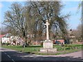
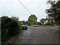
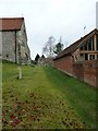
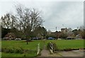
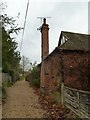
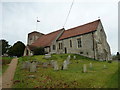
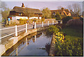
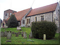
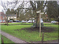
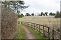
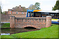
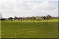
Photos of Cheriton
Area Information
Cheriton is a compact built-up area in England, spanning 22.9 hectares. Its character is defined by a mature population, with a median age of 70, suggesting a community of long-term residents. The area is well-connected to nearby towns such as Alresford and Ropley, offering access to urban amenities while retaining a quieter, more residential feel. A Cheriton Primary School, rated ‘good’ by Ofsted, serves local families, ensuring educational provision for younger generations. Digital connectivity is strong, with a broadband score of 98 and mobile coverage of 80, supporting both work and leisure needs. The area’s safety score of 87/100 indicates a low crime risk, contributing to a sense of security. For buyers, Cheriton balances proximity to essential services with a tranquil environment, though its small size means amenities are concentrated. The mix of home ownership (66%) and rental properties reflects a stable housing market, appealing to those seeking a settled, community-focused lifestyle.
- Area Type
- Built Up Area 250
- Area Size
- 22.9 hectares
- Population
- Not available
- Population Density
- Not available
Cheriton’s residents have access to nearby towns such as Alresford and Ropley, offering retail options like The Southern Co-operative, Tesco Alresford, and Budgens West. These stores provide everyday shopping convenience, from groceries to general goods. The area’s compact size means amenities are concentrated, though the lack of detailed data on parks or leisure facilities suggests a focus on nearby urban centres for recreation. The presence of a primary school and retail hubs indicates a practical, community-oriented lifestyle, where essential services are within reach. While the data does not specify additional leisure options, the proximity to larger towns implies a balance between local convenience and broader opportunities.
Amenities
Schools
The Cheriton Primary School is the only educational institution explicitly listed in the data. Rated ‘good’ by Ofsted, it provides a solid foundation for young learners. The absence of secondary schools or further education institutions in the immediate vicinity means families may need to consider nearby towns like Alresford or Ropley for older children’s schooling. This could be a factor for buyers prioritising a comprehensive school network. The single primary school reflects Cheriton’s focus on serving local, younger families, though the lack of additional schools may necessitate planning for transportation or relocation as children grow.
| Rank | School | Type | Entry gender | Ages |
|---|
Explore more schools in this area
Go to Schools tabDemographics
Cheriton’s population is predominantly older, with a median age of 70. The most common age range is listed as ‘Age: Total’, suggesting a broad demographic spread, though specific breakdowns are not available. Home ownership stands at 66%, indicating a significant proportion of residents own their homes. Accommodation types and household compositions are not detailed, but the data implies a mix of housing stock. The area’s demographic profile suggests a community with established roots, where long-term residency is common. While no specific figures on diversity or deprivation are provided, the high home ownership rate and low crime risk suggest a stable, low-pressure environment. This aligns with the area’s appeal to those prioritising safety and a settled lifestyle over rapid change.
Household Size
Accommodation Type
Tenure
Ethnic Group
Religion
Household Composition
Age
Household Deprivation
NS-SEC
Explore more demographic insights in this area
Go to Demographics tabPlanning
Planning Constraints
- Crime RiskPremium