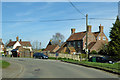
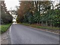
Area Overview for Chearsley
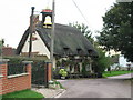
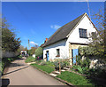
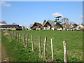
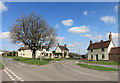
Photos of Chearsley
Area Information
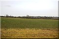
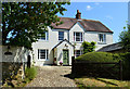
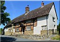
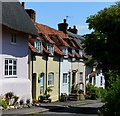
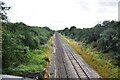
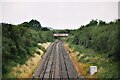
Chearsley is a compact built-up area spanning 28.6 hectares, characterised by its mature population and established infrastructure. With a median age of 70, the area reflects a community predominantly composed of older residents, many of whom are likely long-term residents. The high home ownership rate of 81% suggests a stable, rooted population, with fewer renters than average. Daily life in Chearsley is shaped by its proximity to essential services, including five retail outlets such as Co-op Haddenham and Morrisons Daily, as well as two railway stations—Haddenham & Thame Parkway and Aylesbury Vale Parkway—offering convenient access to regional transport networks. The area’s size, while modest, supports a self-contained lifestyle, blending practicality with the quietude of a less densely populated setting. For those seeking a place with a slower pace, strong community ties, and easy access to amenities, Chearsley offers a distinct alternative to larger towns. Its blend of local shops, transport links, and low crime risk makes it a viable option for buyers prioritising security and convenience.
- Area Type
- Built Up Area 250
- Area Size
- 28.6 hectares
- Population
- Not available
- Population Density
- Not available
Chearsley’s residents have access to a range of nearby amenities that support a practical and convenient lifestyle. Five retail outlets, including Co-op Haddenham, Morrisons Daily, and Asda Thame, provide essential shopping options within easy reach. These stores cater to daily needs, from groceries to household supplies, reducing the necessity for longer trips. The area’s two railway stations—Haddenham & Thame Parkway and Aylesbury Vale Parkway—enhance mobility, offering connections to broader transport networks. While the data does not mention parks or leisure facilities, the presence of local shops and transport links suggests a focus on functional living. The retail options and rail access combine to create a lifestyle that balances self-sufficiency with the flexibility to travel, making Chearsley suitable for those prioritising convenience over expansive recreational amenities.
Amenities
Schools
| Rank | A + A* % | School | Type | Entry gender | Ages |
|---|
Explore more schools in this area
Go to Schools tabDemographics
Chearsley’s population is defined by its median age of 70, indicating a community skewed towards older adults. This age profile suggests a demographic with established routines and limited turnover, which may influence the character of local services and social dynamics. The area’s home ownership rate of 81% is notably high, reflecting a preference for long-term residency over rental properties. This statistic also implies a stable housing market, with fewer speculative investments. While the data does not specify household composition or ethnic diversity, the high home ownership and age profile suggest a population that values continuity and familiarity. The absence of detailed breakdowns on accommodation types or household structures means the area’s social fabric remains largely inferred from its age and ownership statistics. For buyers, this demographic context may signal a community with a distinct rhythm, shaped by the needs and preferences of its older residents.
Household Size
Accommodation Type
Tenure
Ethnic Group
Religion
Household Composition
Age
Household Deprivation
NS-SEC
Explore more demographic insights in this area
Go to Demographics tabPlanning
Planning Constraints
- Crime RiskLocked