Area Overview for Chawton
Photos of Chawton
Area Information
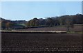
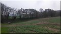
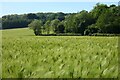
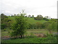
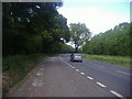
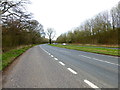
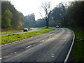
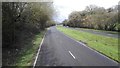
Chawton is a civil parish covering an area of 8.7 square kilometres within England. Living here means inhabiting a space defined by its quiet character and rural setting. The community presents a distinct profile, situated within a landscape that values stability and calm. You will find that daily life revolves around a mature environment where the pace is generally slower than in larger towns. This parish does not benefit from recent large-scale expansion, which maintains its traditional feel. The boundaries of the area are respected, keeping external pressures at bay. Residents enjoy a setting where natural features remain prominent. The village centre and surrounding fields define the local identity. Anyone considering homes in Chawton should prepare for a lifestyle that prioritises stillness over urban excitement. The 8.7-square-kilometre footprint limits density, ensuring that open space remains a key feature. You are looking at an area where history and nature intersect. The population structure reflects a settled community with long-term ties to the land. This background context shapes everything from local services to social interactions. Prospective buyers will encounter a place that resists rapid change. The area stands as a established residential zone. Walking through Chawton, you experience a mix of green spaces and residential clusters. The defined borders help maintain this character. It is a location for those who value a predictable environment.
- Area Type
- Parish
- Area Size
- 8.7 km²
- Population
- Not available
- Population Density
- Not available
Demographics
The community in Chawton has a pronounced median age of 70 years old. This demographic profile indicates that the oldest residents form the heart of the population. Most households consist of individuals or couples in later life, reflected in the age data provided. You will find that the typical resident is well past retirement age. This creates a quiet atmosphere where active play areas may be less common than restful gardens. Home ownership stands at 81 per cent within the area. This high rate suggests that most properties are fully owned rather than rented. Long-term residents have stayed put for decades, likely having purchased their homes early in their lives. The accommodation types reflect this senior focus, often featuring larger dwellings or grounds. There is a notable lack of young families or students in the mix. Daily interactions centre on neighbours of similar ages and interests. Life revolves around leisure, health, and established routines. The population is relatively homogeneous in terms of life stage. This stability means you can expect consistent community dynamics. Local shops and services will cater to this older demographic. Understanding these figures helps you visualise the social fabric. Anyone moving here joins a community defined by age and permanence. The data clearly shows a village suited for retirement or mature living.
Household Size
Accommodation Type
Tenure
Ethnic Group
Religion
Household Composition
Age
Household Deprivation
NS-SEC
Explore more demographic insights in this area
Go to Demographics tabPlanning
Planning Constraints
- Flood RiskLocked
- Ramsar Wetland SitesLocked
- Area of Outstanding Natural BeautyLocked
- Protected Nature ReserveLocked
- Protected WoodlandLocked
- Crime RiskLocked