Area Overview for Charvil
Photos of Charvil


Area Information
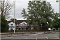
Charvil is a built-up area of 79.2 hectares, nestled in England, offering a compact yet well-defined living environment. With a median age of 70, it reflects a community shaped by older residents, suggesting a mature demographic profile. The area is characterised by a strong sense of local identity, with 80% of homes owned outright, indicating a stable and rooted population. Daily life here is likely to be low-key, with a focus on local amenities and proximity to transport links. Charvil’s sizeable footprint supports a mix of residential and commercial spaces, though its exact character remains defined by the needs of its residents. For those seeking a quieter, established community with practical infrastructure, Charvil provides a foundation of reliability. Its rail connections and retail options within walking distance make it a viable choice for those prioritising convenience over urban vibrancy. While it may not be a hub for nightlife or cultural attractions, its simplicity and accessibility cater to those valuing stability and ease of access to essential services.
- Area Type
- Built Up Area 250
- Area Size
- 79.2 hectares
- Population
- Not available
- Population Density
- Not available
Living in Charvil offers access to a range of nearby amenities, including five retail outlets such as Co-op Petrol, Tesco Twyford, and M&S Twyford BP, ensuring everyday shopping needs are met within practical reach. The area’s rail network, with stations like Twyford and Shiplake, provides direct links to surrounding towns and cities, facilitating both commuting and leisure travel. While the data does not specify parks or recreational facilities, the presence of multiple retail and transport options suggests a focus on practicality over expansive leisure spaces. The character of daily life here is likely to revolve around local shops, regular rail use, and a quiet, settled pace. For those prioritising convenience and accessibility, Charvil’s amenities deliver a straightforward, functional lifestyle without the need for long commutes or extensive travel.
Amenities
Schools
| Rank | School | Type | Entry gender | Ages |
|---|
Explore more schools in this area
Go to Schools tabDemographics
Charvil’s population is predominantly composed of individuals aged 70, with no specific age range dominating beyond this median figure. Home ownership is high, with 80% of residents owning their homes outright, suggesting a community of long-term residents rather than a transient population. The data does not specify household types, accommodation preferences, or ethnic diversity, but the 80% home ownership rate implies a stable demographic with fewer rental properties. This stability may contribute to a cohesive local environment, though the absence of detailed figures on household composition or diversity means broader social dynamics remain unexplored. The area’s older demographic profile may influence local services and amenities, potentially tailoring them to the needs of an ageing population. For buyers, this suggests a community with established roots and a focus on long-term residency rather than short-term investment.
Household Size
Accommodation Type
Tenure
Ethnic Group
Religion
Household Composition
Age
Household Deprivation
NS-SEC
Explore more demographic insights in this area
Go to Demographics tabPlanning
Planning Constraints
- Crime RiskPremium