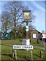
Area Overview for Chart Sutton
Photos of Chart Sutton


Area Information
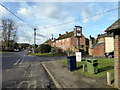
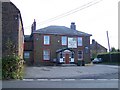
Chart Sutton is a compact built-up area spanning 42.5 hectares, nestled in England. Its character is defined by a mature population, with a median age of 70, suggesting a community shaped by long-term residents. The area’s home ownership rate of 75% indicates a stable, settled demographic, with many properties likely passed through generations. Daily life here is anchored by proximity to essential services: five retail outlets, including Aldi Langley and Morrisons Daily, and five railway stations—Bearsted, Staplehurst, and Hollingbourne—offering connections to nearby towns. The area’s small size fosters a sense of closeness, though its amenities are practical rather than sprawling. For those seeking a quieter, less congested environment with accessible transport, Chart Sutton balances simplicity with connectivity. Its appeal lies in its straightforward infrastructure and the ease of reaching broader networks via rail, making it suitable for commuters or retirees prioritising convenience over urban vibrancy.
- Area Type
- Built Up Area 250
- Area Size
- 42.5 hectares
- Population
- Not available
- Population Density
- Not available
Chart Sutton’s lifestyle is shaped by its proximity to essential amenities. Five retail outlets, including Aldi Langley, Morrisons Daily, and Co-op Maidstone, provide everyday shopping needs within reach. The five railway stations—Bearsted, Staplehurst, and Hollingbourne—offer seamless access to nearby towns, enhancing both social and professional opportunities. While the area lacks expansive parks or leisure facilities, its compact size ensures a sense of efficiency, with services clustered for convenience. For residents, this means minimal travel time for essentials, though those seeking larger recreational spaces may need to venture further. The character of daily life here is pragmatic, centred on accessibility and simplicity, making it ideal for those valuing straightforward living over sprawling amenities.
Amenities
Schools
| Rank | A + A* % | School | Type | Entry gender | Ages |
|---|
Explore more schools in this area
Go to Schools tabDemographics
Chart Sutton’s population skews significantly towards older adults, with a median age of 70. This suggests a community where retirement is the dominant life stage, potentially influencing local services and social dynamics. Home ownership is high, at 75%, indicating a preference for long-term residency over rental properties. The data does not specify household composition or accommodation types, but the overall figures imply a mix of family homes and single-occupancy properties. The area’s demographic profile may affect local amenities, with services tailored to older residents rather than growing families. While no explicit data on diversity or deprivation is provided, the high home ownership rate and age profile suggest a relatively stable, low-turnover community. For prospective buyers, this demographic may align with those seeking a retirement-focused environment or properties in a mature market.
Household Size
Accommodation Type
Tenure
Ethnic Group
Religion
Household Composition
Age
Household Deprivation
NS-SEC
Explore more demographic insights in this area
Go to Demographics tabPlanning
Planning Constraints
- Crime RiskLocked