Area Overview for Charney Bassett
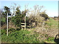
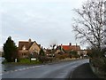
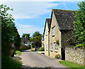
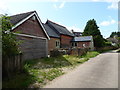
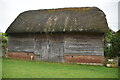
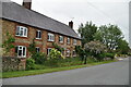
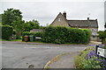
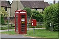
Photos of Charney Bassett
Area Information
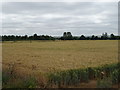
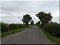
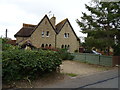
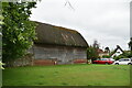
Charney Bassett is a small civil parish covering an area of 4.9 km² in England. It presents a compact living environment where residents enjoy close proximity to local amenities while surrounded by a defined neighbourhood. Living in Charney Bassett means navigating a parish that balances rural land use with residential needs. The scale suggests a quiet community life, distinct from larger urban centres yet connected to the wider region. Daily life here revolves around local resources and the surrounding countryside. This area offers a clear identity as a parish community, providing a specific setting for those seeking a smaller footprint. Understanding the geography of this 4.9 km² space helps buyers visualise potential home locations. The layout supports a settled pace of life, typical of a parish village. Prospective homebuyers should consider how the boundaries of Charney Bassett influence their daily routine. Access to green space is inherent in such a small parish, though specific agricultural or residential zoning requires local council verification. The area stands as a distinct entity within the broader housing market.
- Area Type
- Parish
- Area Size
- 4.9 km²
- Population
- Not available
- Population Density
- Not available
Demographics
The community profile of Charney Bassett reveals a population with a distinctly older age demographic. The median age stands at 70 years, indicating that a significant portion of the residents are in retirement or later life stages. This age distribution shapes the social fabric, suggesting a calm and settled atmosphere. Approximately 77% of households own their homes, a figure that highlights high levels of residency stability compared to many urban areas. This ownership rate implies that most people have lived in the area for an extended period rather than renting short-term contracts. The household composition data reflects these long-term settlement patterns, where families or retirees likely own their properties outright or through mortgage terms managed over decades. There are no indications of a transient population within the total household breakdown. The demographic data confirms a quiet, established neighbourhood where residents are deeply rooted in the locality. When considering homeschool in Charney Bassett, you are entering a community where the majority of neighbours are permanent residents. This stability affects local businesses, community groups, and the general rhythm of the village.
Household Size
Accommodation Type
Tenure
Ethnic Group
Religion
Household Composition
Age
Household Deprivation
NS-SEC
Explore more demographic insights in this area
Go to Demographics tabPlanning
Planning Constraints
- Flood RiskPremium
- Ramsar Wetland SitesPremium
- Area of Outstanding Natural BeautyPremium
- Protected Nature ReservePremium
- Protected WoodlandPremium
- Crime RiskPremium