Area Overview for Charlwood
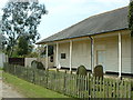
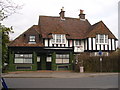
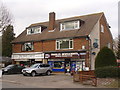
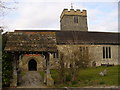
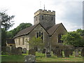
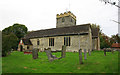
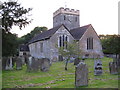
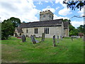
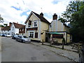
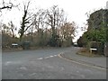
Photos of Charlwood

Area Information
Charlwood is a compact built-up area in England, spanning 66 hectares, with a population skewed towards older residents, many of whom own their homes. The area’s proximity to London Gatwick Airport and its well-connected transport network make it a practical choice for commuters and those seeking access to major travel hubs. Daily life here is shaped by its mature demographic, with a median age of 70, suggesting a community that values stability and established living. The presence of a primary school with a good Ofsted rating adds to the area’s appeal for families with young children, though secondary education options are not listed in the data. Charlwood’s character is defined by its mix of residential housing and practical amenities, offering a balance between quiet living and easy access to retail, transport, and regional infrastructure. For buyers, it’s a place where convenience meets a settled, older population, with a focus on accessibility and connectivity.
- Area Type
- Built Up Area 250
- Area Size
- 66.0 hectares
- Population
- Not available
- Population Density
- Not available
Charlwood’s lifestyle is shaped by its proximity to retail and transport hubs, including Tesco Gatwick, Aldi Manor, and M&S Gatwick North Airport. These shops provide convenient access to groceries and everyday essentials. The area’s rail links, such as Ifield and Gatwick Airport stations, offer easy connections to London and surrounding regions, supporting both commuters and those requiring travel. While parks or leisure facilities are not detailed in the data, the presence of multiple retail and transport options suggests a practical, service-oriented lifestyle. The area’s character is defined by accessibility, with amenities designed for convenience rather than leisure. Residents can expect a straightforward, functional daily life centred around practical needs and regional connectivity.
Amenities
Schools
The primary school nearest to Charlwood is Charlwood Village Primary School, which holds an Ofsted rating of ‘good’. This provides a reliable option for families with young children, though no secondary schools are listed in the data. The presence of a primary school with a strong rating is a positive factor for families prioritising education, but those requiring secondary schooling may need to look beyond the immediate area. The school’s ‘good’ rating suggests it meets acceptable standards in teaching and facilities, though specifics on curriculum or performance are not provided. For parents, this school offers a local solution for early education, but further investigation into secondary options is advisable.
| Rank | School | Type | Entry gender | Ages |
|---|
Explore more schools in this area
Go to Schools tabDemographics
The population of Charlwood has a median age of 70, reflecting a community dominated by older residents. This age profile suggests a demographic that may prioritize low-maintenance living and proximity to essential services. Home ownership is high at 78%, indicating a stable, long-term resident base with fewer rental properties. The data does not specify household composition or accommodation types, but the overall figures suggest a mix of family homes and possibly retirement properties. The area’s older population may influence local services, such as healthcare and community centres, though no specific details are provided. While no deprivation data is available, the high home ownership rate and established infrastructure imply a relatively stable quality of life, though younger families may find the age demographic less aligned with their needs.
Household Size
Accommodation Type
Tenure
Ethnic Group
Religion
Household Composition
Age
Household Deprivation
NS-SEC
Explore more demographic insights in this area
Go to Demographics tabPlanning
Planning Constraints
- Crime RiskPremium