Area Overview for Chalk Ward
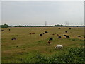
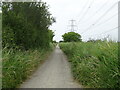
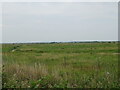
Photos of Chalk Ward

Area Information
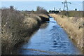
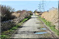
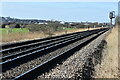
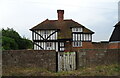
Living in Chalk Ward means residing in a village within the Gravesham district of Kent that adjoins the east side of Gravesend. The postcode district DA12 serves this community, which covers a land area of 5.4 square kilometres. You live on historic ground where the village has been known since the 8th century and was mentioned in the Domesday Book for hosting a Saxon witanagemot. An Iron Age settlement and a large Roman villa, discovered in 1961, indicate early habitation on the land. The area retains strong links to its past, including a former Victorian school site now functioning as a village hall and Charles Dickens honeymooning here to model Joe Gargery's cottage in Great Expectations. Local landmarks include St Mary's Church near an Iron Age settlement site and the historic old forge. Daily life involves navigating the main road where the former White Hart pub stands, now part of the Harvester Restaurant group. The village operates under the dialling code 01474 and is served by Kent Police, Fire, and South East Coast Ambulance. Residents must be aware of a proposed Lower Thames Crossing nearby, which introduces specific infrastructure considerations. This location offers a connection to significant history while facing modern developments. The community size reflects a population of approximately 2,208 people based on available coordinates and population figures. You are situated in a place where literary history meets contemporary village governance, distinct from being a generic district borough unitary ward.
- Area Type
- District Borough Unitary Ward
- Area Size
- 5.4 km²
- Population
- Not available
- Population Density
- Not available
Demographics
The community in Chalk Ward is defined by an older population profile with a median age of 70 years. Most residents fall into the 'Age: Total' category, indicating a mature demographic structure. This age profile influences the local services and amenities you rely on. You are looking at an area where home ownership reaches 79 percent of all households. This high rate indicates that the vast majority of people living here purchased their properties rather than renting. The data shows household composition and accommodation type statistics are recorded, though specific breakdowns for individual categories are not detailed in the provided figures. Diversity metrics for predominant ethnic groups and religious practices exist in the dataset but do not provide specific subgroup percentages. This suggests a community with established characteristics rather than rapid demographic shifts. You should consider that the high home ownership ratio often correlates with stability but may affect rental availability. The age distribution means the area is likely less dominated by young families compared to areas with a median age of 35 or lower. When you consider living in Chalk Ward, expect a quieter neighbourhood dynamics suited to an older demographic. The settlement has shaped a residential pattern where long-term residents dominate the housing stock.
Household Size
Accommodation Type
Tenure
Ethnic Group
Religion
Household Composition
Age
Household Deprivation
NS-SEC
Explore more demographic insights in this area
Go to Demographics tabPlanning
Planning Constraints
- Flood RiskPremium
- Ramsar Wetland SitesPremium
- Area of Outstanding Natural BeautyPremium
- Protected Nature ReservePremium
- Protected WoodlandPremium
- Crime RiskPremium