Area Overview for Central Southsea Ward
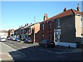
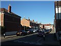
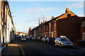
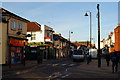
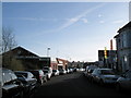
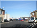
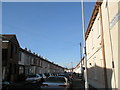
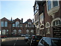
Photos of Central Southsea Ward
Area Information
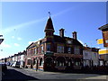
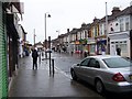
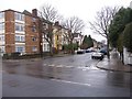
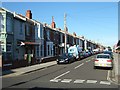
Central Southsea Ward sits on the central southern shoreline of Portsea Island, forming a distinct district within the larger city of Portsmouth. This compact ward covers just 1.0 km², making it a tightly knit neighbourhood with 1983 residents. You will live in a setting defined by its position off the south coast of England in the Solent, approximately 22 miles from Southampton and 74 miles west of London. The area functions as a resort zone where Southsea serves as the primary geographic focus. Local postcodes primarily fall within the PO4 district, placing you firmly within Portsmouth's administrative ward system. Daily life here revolves around immediate access to key amenities such as Southsea Common, South Parade Pier, and Portsmouth Cathedral. The ward falls under the Portsmouth South Borough Constituency, ensuring you are part of a specific local governance structure. You move through an environment where the seafront defines the routine, yet you remain connected to the wider region via major road infrastructure like the M275 motorway and the A3 road. Portsmouth and Southsea Station acts as your primary rail link, facilitating travel to the mainland and beyond. Living in Central Southsea Ward means embracing a coastal lifestyle with defined boundaries and clear local identity.
- Area Type
- District Borough Unitary Ward
- Area Size
- 1.0 km²
- Population
- 1983
- Population Density
- 1924 people/km²
Demographics
The community in Central Southsea Ward presents a clearly defined age profile, with a median age of 70 years. This indicates an area characterised by older residents rather than young families or single professionals. Households here are split on ownership matters, with 48% of residents owning their homes outright or with a mortgage. The remaining households likely secure their residence through other tenure types, given these ownership figures. While the ward contains a total household composition and accommodation type distribution, specific breakdowns for each category remain generalised in the available records. Diversity metrics for ethnic groups, religious affiliations, and detailed household structures are listed as total categories, reflecting the aggregate nature of the local population data. You are likely to find a demographic skew towards retirement age or later-life stages within your immediate neighbours. This age profile influences local services and community activities, as the social fabric adapts to the needs of an older population. Safety considerations also factor into daily life, with crime risk rated at a medium level corresponding to a score of 63 out of 100. This suggests you should adopt standard security precautions, as crime rates here hover around the national average. The ward does not contain protected nature reserves or woodlands, meaning your immediate surroundings are free from specific conservation planning constraints that might affect development.
Household Size
Accommodation Type
Tenure
Ethnic Group
Religion
Household Composition
Age
Household Deprivation
NS-SEC
Explore more demographic insights in this area
Go to Demographics tabPlanning
Planning Constraints
- Flood RiskPremium
- Ramsar Wetland SitesPremium
- Area of Outstanding Natural BeautyPremium
- Protected Nature ReservePremium
- Protected WoodlandPremium
- Crime RiskPremium