Area Overview for Central Meon Valley Ward
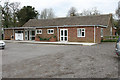
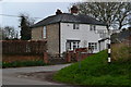
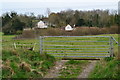
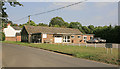
Photos of Central Meon Valley Ward
Area Information
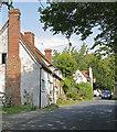
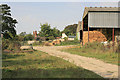
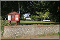
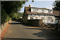
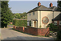
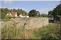
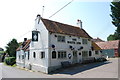
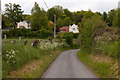
Living in Central Meon Valley Ward offers a distinctly rural experience within the Upper Meon Valley area. This district council ward sits within Winchester City Council in Hampshire, covering a substantial 67.7 square kilometres. You will find yourself situated approximately around 50.9405°N, -1.1212°W, nestled near the River Meon. The location falls under the Winchester parliamentary constituency, connecting your daily life to a well-defined political area. The ward functions as a quiet zone where the landscape is closely tied to the local waterway. Your daily routine here revolves around a community that values its surroundings over urban bustle. The geography dictates a slower pace compared to the wider city. You are part of a specific administrative unit that maintains a clear identity separate from larger boroughs. This area provides a defined space for residents to call home while remaining part of the broader Winchester region. The physical expanse allows for a spread-out living arrangement that suits those seeking space and proximity to nature.
- Area Type
- District Borough Unitary Ward
- Area Size
- 67.7 km²
- Population
- Not available
- Population Density
- Not available
Demographics
The community profile for Central Meon Valley Ward reflects a mature population with a median age of 70 years. You will be living among a demographic that skew significantly towards older adults. This age distribution shapes the social fabric of the neighbourhood. Home ownership stands at a commanding 80% of households, indicating that most residents purchased their properties years ago. This high level of tenure suggests a settled community with long-term residents rather than a transient population. The ward lacks specific data on ethnic diversity and religious composition in the provided records, so you must rely on the clear figures regarding age and ownership. The most common age range for the total population covers the broader spectrum, driven heavily by the high median age. You will not find many young families or students typical of university towns. Instead, the area appeals to those wishing to live nearby without the responsibilities of raising children. The high ownership rate means buyers can expect mostly existing stock rather than new rental developments. This demographic stability creates a quiet atmosphere but limits opportunities for youth-focused amenities.
Household Size
Accommodation Type
Tenure
Ethnic Group
Religion
Household Composition
Age
Household Deprivation
NS-SEC
Explore more demographic insights in this area
Go to Demographics tabPlanning
Planning Constraints
- Flood RiskPremium
- Ramsar Wetland SitesPremium
- Area of Outstanding Natural BeautyPremium
- Protected Nature ReservePremium
- Protected WoodlandPremium
- Crime RiskPremium