Area Overview for Canalside Ward
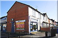
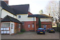
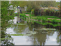
Photos of Canalside Ward


Area Information
Canalside Ward is a compact district covering just 2.5 square kilometres in England. This small footprint creates an intimate neighbourhood where daily routines often rely on local amenities rather than long commutes. Living in Canalside Ward means navigating a space designed for those who value proximity over sprawl. The ward represents a specific microcosm of living within a larger borough, offering a concentrated experience without the anonymity of a larger city. Residents find themselves in an environment where the scale is human and manageable. You will notice immediately that this area caters to a very specific life stage. The character of the ward is defined by its residents rather than grand architecture or commercial hubs. It serves as a quiet enclave within the broader urban fabric. The area size suggests a high density of homes relative to the land available. This concentration shapes the social rhythm of the community, encouraging frequent interaction among neighbours. For anyone considering homes in Canalside Ward, understanding this spatial constraint is vital. The ward does not offer vast green belts or sprawling suburbs. Instead, it provides a contained setting where services and accommodations are within easy reach. This distinct profile makes it a unique proposition for those seeking a manageable living footprint in England.
- Area Type
- District Borough Unitary Ward
- Area Size
- 2.5 km²
- Population
- Not available
- Population Density
- Not available
Demographics
The community profile of Canalside Ward reveals a significant demographic shift compared to many other urban areas. The median age stands at 70, indicating that the population skews heavily towards retirees. This statistic fundamentally influences the character of daily life in the area. Most of the population falls into the broader age categories associated with retirement living. You are not looking at a family-centric neighbourhood with young professionals or school-aged children as the primary demographic. Instead, the social environment reflects the interests and needs of an older generation. Household composition in Canalside Ward displays a notable level of stability. Output data shows that 44% of residents own their homes outright or through a mortgage. This figure is slightly above the national average for some comparable districts, suggesting a significant number of long-term residents. The remaining 56% of households comprise tenants or those living in rental accommodation. This split indicates a mixed economy of housing where staying power is evident among owners, yet rental options remain prevalent. Accommodation types vary, but the age profile suggests a prevalence of flats or bungalows suited to older residents. The demographic data does not suggest rapid turnover or a transient population. Living in Canalside Ward means entering a community defined by its mature age profile and established homeownership patterns.
Household Size
Accommodation Type
Tenure
Ethnic Group
Religion
Household Composition
Age
Household Deprivation
NS-SEC
Explore more demographic insights in this area
Go to Demographics tabPlanning
Planning Constraints
- Flood RiskPremium
- Ramsar Wetland SitesPremium
- Area of Outstanding Natural BeautyPremium
- Protected Nature ReservePremium
- Protected WoodlandPremium
- Crime RiskPremium