Area Overview for Burghfield
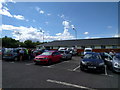
Photos of Burghfield


Area Information
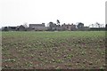
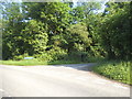
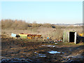
Burghfield is a built-up area situated in England, covering a total size of 65.6 hectares. This specific district functions as a residential hub where daily life revolves around practical access to key services and local facilities. Living in Burghfield means engaging with an environment defined by its compact nature and established infrastructure. The area serves as a practical base for residents who require proximity to shops and trains without relying on distant town centres. You will find a community built around accessibility, where essential amenities like retail outlets and railway connections are within practical reach. The character of Burghfield is shaped by its status as a distinct neighbourhood rather than a sprawling municipality. Homebuyers here benefit from a setting that balances residential density with immediate access to transport nodes such as Theale and Morgan's Heaths stations. Daily routines are streamlined by the presence of major retailers like M&S and Co-op located nearby. This area represents a straightforward choice for those seeking established local infrastructure without the complexity of larger metropolitan sprawl. The 65.6 hectares of built space provide a defined boundary for the community, fostering a sense of locality while maintaining connection to wider Berkshire.
- Area Type
- Built Up Area 250
- Area Size
- 65.6 hectares
- Population
- Not available
- Population Density
- Not available
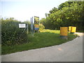
Residents enjoy a convenient lifestyle supported by a network of nearby amenities within practical reach. The retail landscape includes five specific outlets, with notable names such as M&S Reading West M4 Moto SF, M&S Reading East M4 Moto SF, and Co-op Burghfield. These locations provide essential shopping needs without requiring long journeys to larger regional centres. Five railway stations further enhance your ability to travel, including Theale Railway Station, Reading West Railway Station, and Mortimer Railway Station. This rail network offers flexible commuting options, connecting you to major hubs for work or leisure. You can walk or take a short drive to pick up groceries at the Co-op or head to the motorway for regional travel. The availability of these specific venues means your daily errands are handled efficiently. Dining and broader leisure options extend beyond these immediate points, but the core retail and transport infrastructure is solid. Your car and the local train lines will be your main tools for expanding your lifestyle beyond the immediate 65.6 hectares. This setup ensures that basic living is convenient while more extensive trips remain easily accessible via the rail network.
Amenities
Schools
Families relocating to Burghfield have access to a specific selection of educational institutions locally. The primary option available nearby is Burghfield St Mary's C.E. Primary School, which holds a good Ofsted rating. This school serves as the main educational facility for children in the immediate vicinity, providing a recognised standard of teaching within the catchment area. The presence of a primary school with a good rating suggests a functional local education system that meets government standards. However, the data provided does not list any secondary schools or colleges directly within Burghfield. This implies that families with older children will likely need to rely on schools in neighbouring towns such as Reading or Wokingham for secondary education. The single-school profile indicates that the area is supplemented by nearby town centres for comprehensive education. Prospective parents should factor in travel time when assessing if the local primary offering is sufficient for their needs. The mix of school types is currently limited to primary education locally, with secondary options existing beyond the immediate 65.6 hectares of the built-up area.
| Rank | School | Type | Entry gender | Ages |
|---|
Explore more schools in this area
Go to Schools tabDemographics
The community within Burghfield displays a clear demographic profile centred on a significant older population. The median age stands at exactly 70 years, indicating that the most common age group comprises older residents. This data point suggests a neighbourhood with a strong presence of retirees and established families rather than young professionals or students. Home ownership defines the living arrangement for the majority of households, with a home occupancy rate of 71%. This high percentage reflects a settled community where long-term residents have purchased their properties over time. While the median age is high, the area maintains a structured household composition typical of mature residential zones. The population dynamic implies a lower volume of young people entering the housing market compared to areas with a younger median age. Ethnic diversity and religious breakdowns are recorded as part of the total demographic picture, though specific percentages for these groups are not detailed in the current dataset. You can expect a stable population where residents view the area as a permanent home. This demographic snapshot paints a picture of a quiet, established locality where the majority of people have put down roots. Understanding this age distribution helps indicate that the neighbourhood may prioritize leisure and maintenance over nightlife or family-oriented activities.
Household Size
Accommodation Type
Tenure
Ethnic Group
Religion
Household Composition
Age
Household Deprivation
NS-SEC
Explore more demographic insights in this area
Go to Demographics tabPlanning
Planning Constraints
- Crime RiskPremium