Area Overview for Burgess Hill
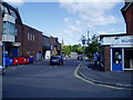
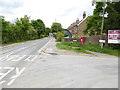
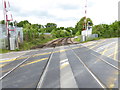
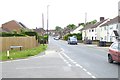
Photos of Burgess Hill

Area Information
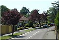
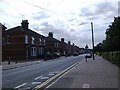
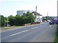
Burgess Hill is a compact built-up area in England, covering 8.7 km² with a population of 9,180 people. Its population density of 1,049 residents per square kilometre suggests a closely knit community, where daily life is shaped by proximity to amenities and local institutions. The area’s character is defined by its mix of residential properties and practical infrastructure, with a median age of 70 indicating a predominantly mature demographic. This makes Burgess Hill a place where stability and established routines are common. Residents benefit from nearby rail connections, including Burgess Hill Railway Station and Wivelsfield, which link to broader regional networks. The area’s appeal lies in its balance of accessibility and quiet living, with a focus on essential services rather than sprawling urban sprawl. For those considering living here, the combination of moderate population size and well-connected transport options offers a practical base for both retirees and professionals seeking a settled environment.
- Area Type
- Built Up Area 250
- Area Size
- 8.7 km²
- Population
- 9180
- Population Density
- 1049 people/km²
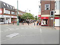
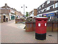
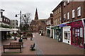
Burgess Hill offers a range of amenities within practical reach, enhancing daily life for residents. Retail options include Iceland Church, Waitrose Burgess, and The Southern Co-operative Co, providing access to groceries, household goods, and other essentials. The area’s rail stations connect residents to broader networks, facilitating travel to nearby towns and cities. While specific parks or leisure facilities are not detailed in the data, the presence of multiple retail and transport hubs suggests a community focused on convenience and accessibility. The mix of shops and transport links supports a lifestyle that balances local convenience with regional connectivity, making Burgess Hill suitable for those prioritising practicality over expansive recreational spaces.
Amenities
Schools
Burgess Hill is served by a range of educational institutions, including primary schools and a specialist unit. London Meed Community Primary School, The Gattons Infant School, and Southway Junior School all hold a “good” Ofsted rating, offering families access to well-regarded primary education. Oak Tree Primary School also contributes to the local school network, though its rating is not specified. The Mid-Sussex Area Pupil Referral Unit provides additional support for students with specific needs. This mix of school types ensures that families have options for both mainstream and specialist education. The presence of multiple primary schools with strong ratings is a key advantage for parents seeking quality schooling for their children, reinforcing Burgess Hill’s appeal as a family-friendly area.
| Rank | School | Type | Entry gender | Ages |
|---|
Explore more schools in this area
Go to Schools tabDemographics
The population of Burgess Hill has a median age of 70, reflecting a community where older adults form a significant proportion. This is reinforced by the most common age range being “Total,” suggesting a broad demographic spread, though specific breakdowns are not provided. Home ownership is high, with 78% of residents owning their homes, indicating a stable housing market and long-term residency patterns. The data does not specify household composition or ethnic diversity, but the high home ownership rate suggests a community prioritising permanence over rental flexibility. The accommodation types are not detailed, but the overall profile points to a mix of properties serving a mature population. While deprivation data is absent, the low crime risk and practical amenities suggest a quality of life focused on security and accessibility for residents.
Household Size
Accommodation Type
Tenure
Ethnic Group
Religion
Household Composition
Age
Household Deprivation
NS-SEC
Explore more demographic insights in this area
Go to Demographics tabPlanning
Planning Constraints
- Crime RiskPremium