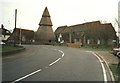
Area Overview for Brookland
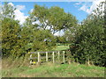
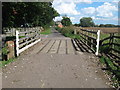
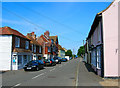
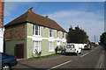
Photos of Brookland


Area Information
Brookland is a compact built-up area spanning 22.8 hectares, nestled in England. Its population, while not explicitly detailed, reflects a median age of 70, suggesting a community skewed toward older residents. The area’s character is shaped by its proximity to multiple transport hubs, including three rail stations—Appledore, Ham Street, and Rye—and two metro stops, New Romney and Romney Warren Halt. This connectivity offers residents access to regional travel and local amenities. Brookland’s appeal lies in its practicality: nearby are two airports, Lydd London Ashford and Lydd, which could benefit those requiring frequent air travel. The area is served by a Church of England Primary School with a good Ofsted rating, ensuring families have access to quality early education. While the data does not specify the exact number of residents, the 70% home ownership rate indicates a stable, long-term community. Daily life here balances quiet living with the convenience of nearby retail options, such as Morrisons and Spar, and the presence of multiple transport links. Brookland is not a sprawling suburb but a focused, functional area for those prioritising accessibility over expansive space.
- Area Type
- Built Up Area 250
- Area Size
- 22.8 hectares
- Population
- Not available
- Population Density
- Not available
Brookland’s residents have access to a variety of amenities within practical reach. The area is served by three rail stations—Appledore, Ham Street, and Rye—and two metro stops, New Romney and Romney Warren Halt, ensuring easy access to regional travel. Retail options include five notable stores, such as Morrissons and Spar, providing everyday shopping convenience. Two airports, Lydd London Ashford and Lydd, are also nearby, offering air travel options. While the data does not specify parks or leisure facilities, the presence of multiple transport hubs and retail spots suggests a lifestyle focused on accessibility and practicality. The area’s compact size means amenities are closely clustered, reducing the need for long commutes. For those prioritising convenience over expansive green spaces, Brookland’s layout offers a functional, connected living experience.
Amenities
Schools
The nearest school to Brookland is the Brookland Church of England Primary School, which has an Ofsted rating of ‘good’. This institution serves the local community, offering primary education to children in the area. While no secondary schools are listed in the data, the presence of a primary school with a positive rating is a key factor for families considering Brookland. The school’s ‘good’ rating suggests it meets acceptable standards in teaching quality and student outcomes, though no further details on its curriculum or facilities are provided. For families requiring secondary education, proximity to other schools would need to be verified separately. The availability of a primary school with a positive rating is a practical advantage for residents, reducing the need for long commutes to education.
| Rank | A + A* % | School | Type | Entry gender | Ages |
|---|---|---|---|---|---|
| 1 | N/A | Brookland Church of England Primary School | primary | N/A | N/A |
Explore more schools in this area
Go to Schools tabDemographics
Brookland’s population has a median age of 70, with the most common age range encompassing the total population. This suggests a community predominantly composed of older individuals, though the data does not specify proportions of younger residents. Home ownership is high, with 70% of households owning their homes, indicating a settled population with long-term ties to the area. The accommodation types and household composition are not detailed in the data, but the 70% ownership rate implies a mix of owner-occupied properties, potentially including family homes or retirement residences. The predominant ethnic group and religious makeup are not specified, so no conclusions can be drawn about cultural diversity. However, the absence of deprivation data means no assessment of socioeconomic challenges is possible. For buyers, the high home ownership rate suggests a stable market, but the age profile may influence local services and amenities tailored to older residents.
Household Size
Accommodation Type
Tenure
Ethnic Group
Religion
Household Composition
Age
Household Deprivation
NS-SEC
Explore more demographic insights in this area
Go to Demographics tabPlanning
Planning Constraints
- Crime RiskLocked