Area Overview for Broadbridge Heath
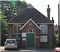
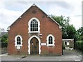
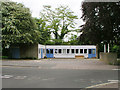
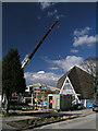
Photos of Broadbridge Heath


Area Information
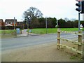
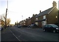
Living in Broadbridge Heath offers a distinct experience within the built-up area of West Sussex, where a small geographic footprint meets a full range of daily necessities. This community spans just 1.3 km², making it a compact and manageable locality for residents who prefer a close-knit environment without the sprawl of larger towns. The area is situated at the edge of Horsham, allowing for quiet domestic life while retaining easy access to wider urban facilities. Daily life here is defined by convenience; you can reach essential services and transport links quickly, avoiding the long commutes common in more distant villages. The layout supports a steady rhythm, blending residential tranquillity with practical accessibility. You will find yourself in an area where the built environment is dense yet functional, devoid of unnecessary expansion. This setting suits those who value proximity to shops and rail stations without needing to venture far for shopping or travel. The character of Broadbridge Heath remains consistent; it is a place where the space you occupy feels secure and well-defined. This compact footprint ensures that nothing is overly distant, creating a lifestyle where your neighbours, local shops, and train station are all within easy reach. The area stands as a self-contained bubble of suburban living that integrates seamlessly with the surrounding Horsham infrastructure.
- Area Type
- Built Up Area 250
- Area Size
- 1.3 km²
- Population
- Not available
- Population Density
- Not available
Daily lifestyle in Broadbridge Heath revolves around a compact set of local amenities and transport hubs. You will find five retail outlets accessible for your weekly shopping needs. These include The Southern Co-operative Co, Tesco Horsham, and Budgens Broadbridge, all within practical reach of the neighbourhood. This selection provides essential grocery options alongside fresh produce and general goods without requiring a long drive. For commuting, rail connectivity is robust, with five railway stations nearby. Christs Hospital Railway Station serves as the primary local hub directly influencing mobility from Broadbridge Heath. Horsham Railway Station and Warnham Railway Station offer further connections for travel to London and other major cities. This transport network ensures you can reach wider opportunities while living in a quieter spot. The concentration of supermarkets and train stations creates a self-sufficient bubble where you can accomplish most errands quickly. You do not need to travel far for food or transport links. The layout of these amenities supports a lifestyle where convenience is a daily priority. Shopping at Budgens or The Southern Co-operative Co becomes a routine activity, while catching a train at Christs Hospital is just a short journey away. This blend of retail and transit defines the character of living in Broadbridge Heath.
Amenities
Schools
Families considering Broadbridge Heath will find Shelley Primary School as the nearest educational establishment listed for the area. This institution is a primary school with an Ofsted rating of good. The rating signifies that the school meets expected standards for teaching quality and student welfare. It provides the main educational route for younger children within the immediate vicinity of the neighbourhood. Parents moving here may find that Shelley Primary School offers a solid foundation for their children's early education. The rating of good is a tangible metric that homebuyers can rely on when assessing the quality of life for a school-age child. There are no secondary schools listed in the provided data for Broadbridge Heath, suggesting that older students likely travel to Horsham or neighbouring towns for upper secondary education. The mix of school options is basic but functional, centred around this one primary option. The school rating does not indicate any urgent improvements are needed, providing reassurance to parents looking for a dependable start for their children. You can expect Shelley Primary School to be a key fixture in the local calendar, hosting events and managing the intake for residents living in Broadbridge Heath or nearby hamlets.
| Rank | School | Type | Entry gender | Ages |
|---|
Explore more schools in this area
Go to Schools tabDemographics
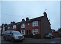
The community in Broadbridge Heath displays a clear demographic pattern focused on older occupants. The resident population has a median age of 70, indicating that the area primarily houses senior citizens. Most common age bundles skew towards retirees rather than young families or working-age adults. Home ownership stands at a high level, with 72% of dwellings owned outright or with a mortgage. This figure suggests that renting is not the primary housing arrangement in this neighbourhood. Accommodation types reflect this stability, though specific breakdowns of terraced versus detached homes are not provided in current records. The household composition leans toward established residents who have maintained ties to the area for many years. You will not see high churn rates in the typical sense, as long-term occupancy dominates the local fabric. Ethnic diversity data is included in the general census totals but does not highlight a single predominant group in the way it might for other districts. Religion profiles also fall under general census categories without detailed local splits visible in the summary. Low deprivation indicators support the quality of life picture, meaning residents generally enjoy better access to resources and higher life expectancy compared to wealthier regions. This demographic mix creates a stable, settled atmosphere where change comes slowly. The area is not undergoing regeneration or attracting large numbers of new young professionals. Instead, it serves as a retirement destination where stability and permanence are the norm.
Household Size
Accommodation Type
Tenure
Ethnic Group
Religion
Household Composition
Age
Household Deprivation
NS-SEC
Explore more demographic insights in this area
Go to Demographics tabPlanning
Planning Constraints
- Crime RiskPremium