Area Overview for Brightwell-cum-Sotwell
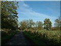
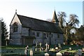
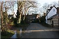
Photos of Brightwell-cum-Sotwell


Area Information
Brightwell-cum-Sotwell is a compact built-up area in England, covering 76.6 hectares. It is a small, established community with a median age of 70, suggesting a population skewed towards older residents. The area is predominantly owner-occupied, with 81% of homes owned by their occupants, reflecting a stable, long-term demographic. Living here means access to essential services within walking or short driving distance, including primary schools, rail stations, and retail outlets. The proximity to Wallingford and multiple railway stations, such as Cholsey and Didcot Parkway, provides easy links to nearby towns and cities. While the area is not expansive, its compact size ensures a close-knit feel, with amenities like Asda and Waitrose within reach. For those prioritising safety, the crime risk score of 84/100 indicates a below-average crime rate, making it a secure place to live. Brightwell-cum-Sotwell offers a quiet, low-key lifestyle with practical connectivity, appealing to those seeking a settled, community-focused environment.
- Area Type
- Built Up Area 250
- Area Size
- 76.6 hectares
- Population
- Not available
- Population Density
- Not available
Brightwell-cum-Sotwell offers a blend of practical amenities for daily life. Retail options include Asda Rectory, Lidl Lupton Road, and Waitrose Wallingford, providing grocery and household needs. The nearby railway stations, such as Cholsey and Appleford, connect residents to broader networks, while Wallingford serves as a local metro hub. Airports like RAF Benson and Chalgrove are within reach, offering regional travel options. The area’s compact size ensures these amenities are accessible without long commutes. While parks or leisure facilities are not specified in the data, the presence of multiple retail and transport hubs suggests a lifestyle focused on convenience and connectivity. This makes Brightwell-cum-Sotwell ideal for those prioritising ease of access to services over large-scale recreational spaces.
Amenities
Schools
Brightwell-cum-Sotwell has two primary schools: Brightwell-Cum-Sotwell Church of England (C) Primary School and Brightwell-Cum-Sotwell Church of England Primary School. Both are state-funded and likely serve the local community, though the data does not provide Ofsted ratings or student performance metrics. The presence of two primary schools suggests a focus on early education, though the lack of secondary schools means families may need to look further afield for secondary education. The dual names may indicate either a single school with different designations or two distinct institutions, but the data does not clarify this. For parents, the availability of primary schools is a key consideration, though the absence of secondary options could influence decisions about long-term residency.
| Rank | A + A* % | School | Type | Entry gender | Ages |
|---|---|---|---|---|---|
| 1 | N/A | Brightwell-Cum-Sotwell Church of England (C) Primary School | primary | N/A | N/A |
| 2 | N/A | Brightwell-Cum-Sotwell Church of England Primary School | primary | N/A | N/A |
Explore more schools in this area
Go to Schools tabDemographics
The population of Brightwell-cum-Sotwell has a median age of 70, the highest in the dataset, indicating a community predominantly composed of older adults. This age profile suggests a demographic focused on retirement or long-term residency, with fewer younger families present. Home ownership is high at 81%, reflecting a stable housing market where most residents are homeowners rather than renters. The data does not specify household composition or accommodation types, but the overall figures imply a mix of family homes and single-occupancy properties. The lack of detailed diversity metrics means the ethnic and religious composition remains unspecified, though the area is described as having a ‘total’ representation in these categories. This demographic profile shapes a community characterised by familiarity and continuity, with residents likely prioritising stability and proximity to essential services.
Household Size
Accommodation Type
Tenure
Ethnic Group
Religion
Household Composition
Age
Household Deprivation
NS-SEC
Explore more demographic insights in this area
Go to Demographics tabPlanning
Planning Constraints
- Crime RiskLocked