Area Overview for Brighton Hill Ward
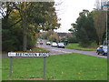
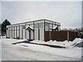
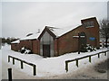
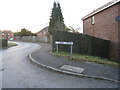
Photos of Brighton Hill Ward
Area Information
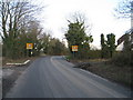
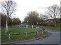
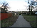
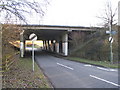
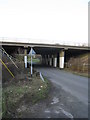
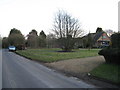
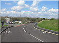
Living in Brighton Hill Ward offers a distinct experience within Basingstoke, Hampshire, defined by its specific boundaries and established community feel. This area covers 2.4 square kilometres and holds a population of 2,806 residents, creating a local environment that is neither too dense nor isolated. The ward is situated at approximately 51.243° N, 1.111° W, and its layout is shaped by significant infrastructure. You will find the Hatch Warren housing estate and the A30 bordering the area to the west. To the east, the Viables Industrial Estate and the Cranbourne area form a natural boundary. The M3 motorway runs directly to the south, adjacent to the Old Hatchwarren area, providing clear major route access. Historically, Brighton Hill developed from the 1970s as part of Basingstoke's Town Centre Development Plan, evolving into the urban area known today. While the eastern section contains older routes like Cranbourne Lane, the western side reflects more recent planning decisions. Ward boundaries were officially redefined in 2021 following a review by the Local Government Boundary Commission, ensuring the current map matches the modern settlement pattern. Residents of Brighton Hill Ward benefit from these clear geographical markers, which include connections via The Harrow Way to nearby roads. Daily life here is characterised by proximity to these key thoroughfares, making travel both predictable and efficient for those seeking homes near these major junctions.
- Area Type
- District Borough Unitary Ward
- Area Size
- 2.4 km²
- Population
- 2806
- Population Density
- 1156 people/km²
Demographics
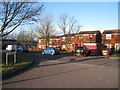
The community within Brighton Hill Ward is statistically defined by an older demographic profile. The median age for residents stands at 70 years, indicating that the area is primarily inhabited by seniors. Although the most common age range data simply lists Age as Total, the central tendency of 70 years dominates the social fabric. This older population structure suggests a neighbourhood where quiet and stability are likely priorities for current homeowners. Home ownership is a significant factor in this snapshot, with 58% of households owning their property outright or with a mortgage. This rate confirms that a steady majority of residents are settled owners rather than tenants. The data indicates broad coverage for household composition, accommodation types, and predominant ethnic groups across the ward. While specific breakdowns for these categories are not detailed in the provided figures, the existence of these data points confirms a standard statistical record exists for the area. The religious and accommodation type data further support the picture of an established residential zone. For potential buyers, the 58% ownership rate is a concrete indicator of market stability. The high median age explains why you might encounter large family homes or groups of terraced properties suitable for downsizing. Understanding that 2,806 people reside in just 2.4 km² helps you appreciate the population density, which sits at 1,156 people per square kilometre. This figure explains why daily services are accessible within short walking or driving distances.
Household Size
Accommodation Type
Tenure
Ethnic Group
Religion
Household Composition
Age
Household Deprivation
NS-SEC
Explore more demographic insights in this area
Go to Demographics tabPlanning
Planning Constraints
- Flood RiskPremium
- Ramsar Wetland SitesPremium
- Area of Outstanding Natural BeautyPremium
- Protected Nature ReservePremium
- Protected WoodlandPremium
- Crime RiskPremium