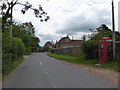
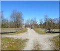
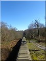
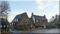
Area Overview for Brightling
Photos of Brightling
Area Information
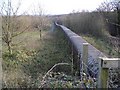
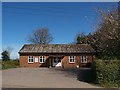
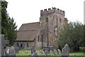
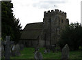
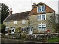
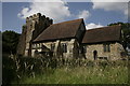
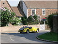
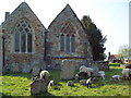
Brightling is a civil parish situated in Sussex, covering a total area of 19.8 square kilometres. Living in this parish offers a distinct lifestyle characterised by significant green space and a quieter pace of life. The community centre is defined by its long-standing status as a rural haven, where the landscape shapes daily routines more than dense urban infrastructure does. Residents enjoy open skies and a connection to the countryside that is difficult to find in larger towns. The parish does not contain Ramsar wetland sites, areas of outstanding natural beauty designations, or protected nature reserves within its boundaries. However, the presence of protected woodland remains a notable feature of the local environment. You will find that the landscape is designated with specific conservation status regarding woodlands, which influences how development occurs across these 19.8 square kilometres. This designation ensures that the natural character of the parish is maintained for future generations while allowing for essential green corridors. The absence of major planning constraints like AONBs simplifies some considerations for those mindful of environmental rules, though the protected woodland adds a layer of stewardship to the area's identity. For those considering homes in Brightling, the environment provides a stable backdrop defined by its size and ecological protections. The area remains true to its rural roots without the overlay of large-scale industrial sites or special flood zone warnings affecting the majority of the land. Your days here will involve interacting with a space where nature conservation balances with residential life. The sheer size of the parish allows for varied micro-environments within its borders, offering a sense of openness that defines the daily experience.
- Area Type
- Parish
- Area Size
- 19.8 km²
- Population
- Not available
- Population Density
- Not available
Demographics
The community in Brightling is defined by an older demographic profile, with a median age of 70. This statistic places Brightling among the older rural communities in the region, reflecting the draw of countryside living for retirees and long-term residents. The most common age range described in the available figures is simply labelled as Total Age, indicating a broad distribution rather than a concentration in younger working-age brackets. With a home ownership rate of 84%, this area is overwhelmingly settled. This high level of tenure stability suggests a population that has remained in the parish for extended periods, avoiding the churn typical of high-rent urban centres. You are likely to encounter neighbours who have built deep community ties over decades rather than transient occupants. The accommodation type data covers the parish as a whole without distinguishing between specific housing categories in the provided breakdown. This uniformity supports the idea of a coherent residential landscape rather than a fragmented mix of student housing or short-term lets. Diversity metrics including predominant ethnicity and religion are noted in the data but presented without specific percentages, highlighting that the community functions as a cohesive whole. The household composition figures similarly reflect a total aggregate, reinforcing the static nature of the local society. For buyers looking at homes in Brightling, this demographic reality means you are entering a well-established neighbourhood where residents share common values and long-term stability. The low turnover associated with such high ownership rates also implies a consistent community culture where local traditions persist. When evaluating living in Brightling, consider that your neighbours will likely be part of this same settlement cycle, ensuring a predictable and settled atmosphere.
Household Size
Accommodation Type
Tenure
Ethnic Group
Religion
Household Composition
Age
Household Deprivation
NS-SEC
Explore more demographic insights in this area
Go to Demographics tabPlanning
Planning Constraints
- Flood RiskPremium
- Ramsar Wetland SitesPremium
- Area of Outstanding Natural BeautyPremium
- Protected Nature ReservePremium
- Protected WoodlandPremium
- Crime RiskPremium