Area Overview for Brent Ward
Photos of Brent Ward


Area Information
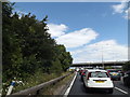
Living in Brent Ward means residing within a compact 2.4 km² district in the Dartford Borough of Kent. You will find yourself just a few miles from Dartford town centre, positioned centrally at coordinates near 51.434664, 0.235696. The area carries the DA1 postcode, with specific premises such as DA1 1FD falling directly within its bounds. Daily life here is defined by its high concentration of age-specific housing and historic architecture. You are surrounded by Grade II listed buildings, including 1 and 3 Overy Street and 11 and 13 Overy Street in New Town, Dartford. These recognised structures stand as tangible links to the past within a modern ward. The sheer size of the area suggests a self-contained community rather than a sprawling suburb. While the ward is small by metropolitan standards, its location grants access to wider infrastructure networks. The concentration of older residents shapes the local rhythm, creating a quiet, established atmosphere. When considering homes in Brent Ward, you are entering a space where historical significance meets current residential needs without the noise of rapid urban expansion.
- Area Type
- District Borough Unitary Ward
- Area Size
- 2.4 km²
- Population
- Not available
- Population Density
- Not available
Demographics
The community in Brent Ward is distinctly mature, with a median age sitting at 70 years. This figure indicates that you are looking at an area overwhelmingly populated by retirees. The household composition reflects this senior demographic,の結果 only 78% of residents own their homes outright. This ownership rate is significant, suggesting a stable population with long-term roots in the ward. The remaining 22% likely consists of tenants or individuals still paying mortgages, though the data categorisation confirms the high homeownership baseline. Specific details regarding ethnic groups, religious affiliations, and precise age breakdowns are not provided in the current dataset. However, the median age of 70 is a definitive fingerprint of the area. You can expect neighbours who share similar life stages and priorities. This age profile often translates to quieter streets and a slower pace compared to family-heavy suburbs. The lack of younger age range data reinforces the idea that this is not a family destination but a retirement haven. Living in Brent Ward means engaging with a population that has prioritised purchasing property late in life, resulting in a community built on stability and established routines.
Household Size
Accommodation Type
Tenure
Ethnic Group
Religion
Household Composition
Age
Household Deprivation
NS-SEC
Explore more demographic insights in this area
Go to Demographics tabPlanning
Planning Constraints
- Flood RiskPremium
- Ramsar Wetland SitesPremium
- Area of Outstanding Natural BeautyPremium
- Protected Nature ReservePremium
- Protected WoodlandPremium
- Crime RiskPremium