Area Overview for Brenchley and Matfield
Photos of Brenchley and Matfield

Area Information
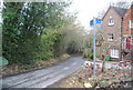
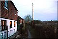
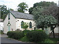
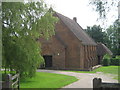
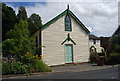
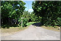
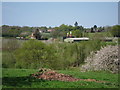
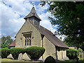
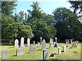
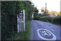
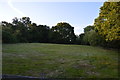
Brenchley and Matfield is a civil parish situated in the Borough of Tunbridge Wells, Kent, covering 21.9 km². This village community comprises the settlements of Brenchley and Matfield along with the hamlets of Castle Hill and Petteridge. The area lies off the A21, accessible via the B2162 between Horsmonden and Matfield. It is positioned eight miles east of Royal Tunbridge Wells and three miles south of Paddock Wood. The landscape is defined by a historic wooded setting and modern field amalgamation, creating a rural character that surrounds the village centres. You will find protected woodland within the boundaries, adding to the quiet, established feel of the parish. The population stands at approximately 1,856 residents, fostering a close-knit environment. Living in Brenchley and Matfield means enjoying a setting with deep historical roots, ranging from Saxon origins to the era of the Peasants' Revolt. The village features Grade 1 listed All Saints Church, established around 1233, and the Old Palace, a half-timbered building dating back to the early 15th century. This mix of heritage and countryside defines daily life here. Homes in Brenchley and Matfield offer a distinct rural experience, blending historic architecture with open spaces. The location sits in the shadow of the A21, providing road connectivity while maintaining a separation from the busiest traffic arteries. You gain access to local amenities within the village indices while remaining close to wider transport links. The community profile of Brenchley and Matfield reflects a mature settlement with a median age of 70 years. This high median age suggests the area attracts older residents or those seeking a slower pace of life. The total household composition and accommodation type data are recorded for the entire parish, indicating a comprehensive view of how people live here. Home ownership is the dominant tenure method, with 80% of households owning their properties outright or with a mortgage. This high level of ownership points to a stable community where residents have long-standing ties to the neighbourhood. While specific details on ethnicity and religious affiliation are part of the total demographic records, the overwhelming ownership rate shapes the social fabric. The age distribution shows that the "total" population is weighted heavily toward older demographics, which influences local services and community activities. You are looking at an area where the population has an established rhythm. Most families in Brenchley and Matfield are settled, and the low rate of renting correlates with the strong sense of place. The demographic make-up means that social interactions often revolve around local institutions and shared community history. When you consider buying here, you enter a market where long-term residents hold the majority of homes. The lack of a significant younger population skew means fewer transient lifestyles dominate the village streets. Instead, you find a consistent resident base that values privacy and established surroundings. The data confirms that nearly five out of every ten households are owner-occupied, reinforcing the stability of the area. The housing landscape in Brenchley and Matfield is characterised by a strong owner-occupier base. With 80% of households owning their homes, this parish operates largely as an owner-occupied market rather than a rental hub. This statistic implies that the majority of properties are held in perpetuity, reflecting a long-term commitment from residents. When you look at accommodation types, the total figure encompasses all dwellings within the parish boundaries, yet the high ownership rate suggests a shortage of available rental stock. This situation means that private money is the primary force in local transactions, rather than the private rented sector. You will find that homes in Brenchley and Matfield are often family residences or retirement homes, given the age profile of the area. The property stock includes both modern field amalgamations and historic cottages near the High Street. The high ownership percentage indicates that sellers in this location are typically individuals, possibly downsizers or empty nesters, rather than institutional landlords. Buying a home here requires engagement with a market driven by personal ownership history. The total accommodation count does not break down by specific tenure, but the 80% ownership figure is a clear indicator of market dynamics. This stability can offer security for buyers, as the area is not subject to the volatility often seen in heavily rented regions. However, the dominance of owner-occupiers may make it challenging for new entrants to find connection deals without a substantial deposit. You are essentially buying into a community where residents have already put down roots. Digital connectivity in Brenchley and Matfield varies between fixed and mobile networks. Mobile coverage scores an 84 out of 100, indicating a good quality signal throughout most of the parish. This rating suggests you can rely on cellular networks for daily communication and on-the-go internet access. In contrast, fixed broadband quality scores 63 out of 100, which rates as a fair connection. While this figure supports standard internet use, it may not suffice for heavy‑bandwidth workloads. For someone working from home, the mobile score offers a reliable fallback, but the broadband score suggests planning for activities that demand high‑speed fixed lines. You should verify specific speeds before committing to remote work arrangements in Brenchley and Matfield. The area is accessed off the A21 via the B2162, providing road links to Major towns like Royal Tunbridge Wells and Paddock Wood. There is no parish rail station mentioned in local records, meaning public transport relies on road networks. Residents typically travel three miles north to Paddock Wood station for train services. This distance creates a reliance on driving for broader connectivity. The fair broadband rating means that high‑definition video calls or large file transfers may sometimes experience delays. Living in Brenchley and Matfield requires you to value road access over rail convenience. The good mobile score is an asset for mobile workers who may move between locations within the parish. However, for those needing consistent, high‑speed internet at a single desk, the fixed network has limitations. You must weigh the fair broadband score against the convenience of the B2162 road links. Safety and environmental factors in Brenchley and Matfield present a balanced picture of a peaceful but monitored parish. The crime risk assessment assigns a level of PASS with a safety score of 84 out of 100. This indicates below‑average crime rates, confirming that the neighbourhood is safer than the national norm. You can expect low crime risk, which supports a tranquil lifestyle for residents. Flood risk is similarly low, with a score of 1.98 out of 100, meaning coverage is minimal and threats are negligible. Planning constraints include a warning for protected woodland, which accounts for a score of 10.26 out of 100. This detail means development in these specific zones faces strict limitations to preserve natural habitats. There are no Ramsar wetland sites, Areas of Outstanding Natural Beauty, or protected nature reserves directly affecting the build-up, as all these categories receive a PASS level with a score of zero. The conservation of the area is therefore driven primarily by the protected woodland rather than broader landscape designations. When considering homes in Brenchley and Matfield, you benefit from a location with low flood risk and low crime. The protected woodland warning is a planning consideration rather than an immediate safety threat to you as a resident. It ensures that the green corridors remain intact for future generations. You do not need to worry about the high-risk elements often cited in other regions. The area maintains a safe environment where the primary constraint is preserving the existing wooded landscape. Your day-to-day life is supported by robust safety metrics across board. What defines the community feel of Brenchley and Matfield?The community feels established and mature, with a median age of 70. The population of approximately 1,856 residents lives in a rural parish that values its historic roots. High home ownership at 80% suggests a community where long-term stability is the norm. You will find a setting dominated by older residents who have deep ties to the area. How does transport work for daily commutes in Brenchley and Matfield?Residents access the area off the A21 via the B2162, linking Horsmonden and Matfield. There is no local rail station, placing the nearest link three miles north at Paddock Wood. Mobile coverage is good at an 84/100 score, but fixed broadband is fair at 63/100. Driving remains the primary mode for broader connectivity. Is Brenchley and Matfield a safe place to live?Yes, the area has a strong safety score of 84 out of 100, indicating below-average crime rates. Flood risk is negligible with a score of 1.98. The main planning concern is protected woodland, which carries a warning score of 10.26, but this does not impact general safety. The environment is secure and well-monitored. What is the ownership structure of homes in Brenchley and Matfield?An overwhelming 80% of households own their homes, making this an owner-occupied market. This high rate implies that the area attracts buyers looking to settle rather than renters seeking flexibility. The total demographic profile supports a stable, non-transient population.
- Area Type
- Parish
- Area Size
- 21.9 km²
- Population
- Not available
- Population Density
- Not available
Demographics
Household Size
Accommodation Type
Tenure
Ethnic Group
Religion
Household Composition
Age
Household Deprivation
NS-SEC
Explore more demographic insights in this area
Go to Demographics tabPlanning
Planning Constraints
- Flood RiskLocked
- Ramsar Wetland SitesLocked
- Area of Outstanding Natural BeautyLocked
- Protected Nature ReserveLocked
- Protected WoodlandLocked
- Crime RiskLocked